Cromford Canal Walk to Whatstandwell
![]()
![]() Enjoy a waterside stroll along the Cromford Canal on this easy walk in Derbyshire. This section of the canal runs from Cromford to Whatstandwell and Ambergate and is designated as a Biological Site of Special Scientific Interest and a Local Nature Reserve. The walk passes the Leawood Pump House by the aqueduct over the River Derwent and a series of pretty bridges. You'll also pass Shining Cliff Woods and enjoy lovely views of the Derwent Valley. The walk makes use of the Derwent Valley Heritage Way so you could continue along this long distance walking route to extend your walk.
Enjoy a waterside stroll along the Cromford Canal on this easy walk in Derbyshire. This section of the canal runs from Cromford to Whatstandwell and Ambergate and is designated as a Biological Site of Special Scientific Interest and a Local Nature Reserve. The walk passes the Leawood Pump House by the aqueduct over the River Derwent and a series of pretty bridges. You'll also pass Shining Cliff Woods and enjoy lovely views of the Derwent Valley. The walk makes use of the Derwent Valley Heritage Way so you could continue along this long distance walking route to extend your walk.
The canal is located just a few miles south of Matlock.
Postcode
DE4 3RQ - Please note: Postcode may be approximate for some rural locationsCromford Canal Ordnance Survey Map  - view and print off detailed OS map
Cromford Canal Open Street Map  - view and print off detailed map
*New* - Walks and Cycle Routes Near Me Map - Waymarked Routes and Mountain Bike Trails>>
Cromford Canal OS Map  - Mobile GPS OS Map with Location tracking
Cromford Canal Open Street Map  - Mobile GPS Map with Location tracking
Pubs/Cafes
Head to Wheatcroft’s Wharf at Cromford Mills for some lovely canalside refreshments. There's several tables right next to the water making it the ideal spot to relax on a fine day. They have a good menu with fresh ‘made to order’ food from oven baked potatoes to homemade soup, Paninis, Pizza, summer salads or a simple sandwich.
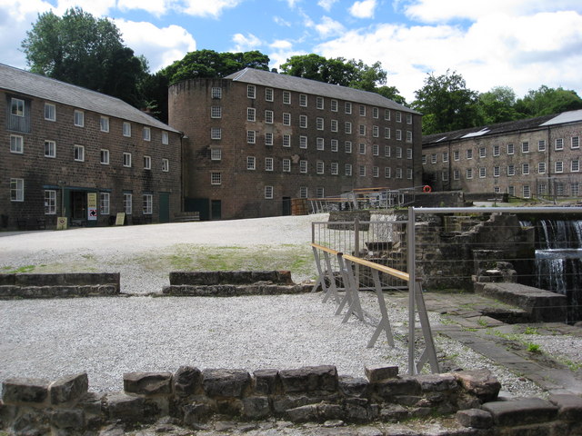
The site is also worth spending some time at with a wealth of information on this area. Cromford Mill is the home of Sir Richard Arkwright’s first mill complex, birthplace of the modern factory system and internationally recognised as a UNESCO World Heritage Site. Inside the centre there's interactive displays, games and puzzles that tell the story of how the valley changed the world in the 18th Century with the growth of the British cotton industry and its global impact. You can find the site at a postcode of DE4 3RQ for your sat navs.


Pictured above the Arkwirght Mill and the cafe at Cromford Mills.
Dog Walking
The canal path makes for an excellent dog walk. You could also take a detour and visit Shining Cliff Woods on the western side of the canal near Ambergate. It's another popular spot for dog walkers. Cromford Mills mentioned above is also dog friendly. Dogs on leads are welcome in the Visitor Centre and Cromford Mills Story, but are not permitted to go into the Arkwright Experience as the show contains flashing lights and loud sounds.
Further Information and Other Local Ideas
The canal passes close to the village of Crich which is well worth a small detour from the route. This pretty village is known as the location for the setting for the ITV series Peak Practice and the excellent Crich Tramway Village. This fascinating museum contains over 60 trams built between 1873 and 1982 and is set within a recreated period village containing a working pub, cafe, old-style sweetshop and tram depots.
Also on the canal is the fascinating Midland Railway Centre where you can admire the old steam trains, explore a delightful 35 acre country park and vist the attractive Codnor Park Reservoir.
For more walking ideas in the area see the Derbyshire Walks and Peak District Walks pages.
Cycle Routes and Walking Routes Nearby
Photos
The Cromford Canal at Langley Mill during the summer of 2007. This was at one time the point where the Nottingham Canal joined the Cromford Canal, which in turn joined the Erewash Canal below the lock out of shot to the left. The Erewash Canal nowadays provides the only navigable access to this location. Until the 1990s this scene would have been in Nottinghamshire rather than Derbyshire, the area technically being known as Langley Bridge. The boundary was changed to follow a more logical course along the Eastwood by-pass rather than the River Erewash thus bringing the whole of Langley Mill into one parish.
Looking across Railway line, A6, River Derwent towards Shining Cliff Woods. The canal’s calm waters provide a home for water birds such as moorhens, coots, mallards, and kingfishers, the latter often seen darting low over the water. Grey herons can also be spotted standing motionless at the water’s edge, waiting to catch fish. The reed-lined banks and still waters create a suitable environment for amphibians such as frogs and newts, while dragonflies and damselflies are common in summer.
Railway bridge over former course of Cromford Canal. This railway bridge for the dismantled Ambergate to Codnor line is situated at the eastern end of the car park of the Excavator pub on the A610, Buckland Hollow. Cromford canal used to flow under this bridge and also through the Buckland Hollow Tunnel, which leads under the Heage road. The tunnel can be found at the other end of the car park.
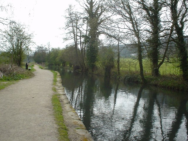
The stretch just to the east of Leawood Aqueduct. The towpath now forms part of the Derwent Valley Heritage Way footpath. Crich Stand with the Sherwood Foresters memorial beacon can be seen in the distance.
The towpath is bordered by trees and hedgerows, including alder, willow, and hawthorn, providing shelter for small birds such as wrens, blackcaps, and finches. Woodpeckers can sometimes be heard drumming from nearby woodland. In the surrounding grassland, butterflies such as the peacock and speckled wood are often seen in warmer months. Mammals in the area include water voles, which are a conservation priority, as well as otters that occasionally move through the canal’s waters.
Near Cromford. The canal bought materials to Cromford Mill and took away the products. It is now a useful part of a circular walk in the area.
Leawood Pump House in background. The canal itself has historical significance, having been built in the late 18th century to transport goods such as coal and lead from Derbyshire’s industrial sites. It played a key role in the region’s industrial past, with Cromford being closely linked to the pioneering mills of Richard Arkwright, an important figure in the development of the textile industry. Today, the canal is a designated Site of Special Scientific Interest due to its diverse aquatic and plant life.


