Crowhurst Walks
![]()
![]() This pleasant circular walk from the East Sussex village of Crowhurst takes you to the nearby Fore Wood RSPB Nature Reserve.
This pleasant circular walk from the East Sussex village of Crowhurst takes you to the nearby Fore Wood RSPB Nature Reserve.
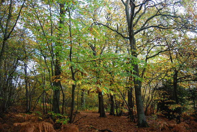
You can reach the reserve by following the Bexhill link of the 1066 Country Walk north from the village. The waymarked trail will take you into Fore Woods where there are a number of walking trails to explore. These peaceful bluebell woods are run by the RSPB and include a number of steep-sided ravines (ghylls) where rare ferns grow. Keep your eyes peeled for birds including Marsh Tit, Redwing and Chaffinch as you make your way along the trails.
Crowhurst Ordnance Survey Map  - view and print off detailed OS map
Crowhurst Open Street Map  - view and print off detailed map
Crowhurst OS Map  - Mobile GPS OS Map with Location tracking
Crowhurst Open Street Map  - Mobile GPS Map with Location tracking
Walks near Crowhurst
- Hastings Circular Walk - This fine circular walk around Hastings visits the coast and countryside to the east of the town
- Hastings Country Park - Enjoy over 600 acres of beautiful parkland and coast on this circular route in Hastings
- Hastings to Winchelsea Coastal Walk - This lovely walk follows the Saxon Shore Way and the Royal Military Canal Path from Hastings to Winchelsea
- 1066 Country Walk - Follow in the steps of William the Conqueror on this historic walk through the Sussex countryside which commemorates the famous battle in 1066.
- Saxon Shore Way - Explore Kent's ancient coastline as you visit Iron Age hill forts, cathedrals, Martello towers, historic ports and castles on this incredible 160 mile walk
- Fairlight - This East Sussex based village has some lovely coastal trails, a fine local country park and a canalside path for walkers to try.
- Winchelsea - This small East Sussex town is a fine place for a historical walk
- Combe Valley Greenway - This walk follows the Combe Valley Greenway and other footpaths around the Combe Valley Countryside park in Sussex.
Pubs/Cafes
The Plough Inn dates back to 1805 and serves good quality food. The friendly rural village local freehouse has some splendid views over the Sussex Weald. They have a garden, a car park and are also dog friendly. You can find them at postcode TN33 9AW.
Further Information and Other Local Ideas
If you continue north along the 1066 walk link you can visit the historic Battle Abbey, site of the Battle of Hastings.
Head south along the trail and it will take you to the seaside town of Bexhill.
Also to the south is the Combe Valley Greenway. This shared cycle and walking route will take you through the lovely Combe Valley Countryside Park where you will find reedbed, fen, riverside paths, countryside trails, a nature reserve and a wide variety of wildlife.
For more walking ideas in the area see the Sussex Walks and the High Weald Walks page.
Photos
The Crowhurst Yew in St George's parish churchyard, Crowhurst, Surrey. This ancient tree is estimated to be about 4,000 years old; maybe twice the age of the church in whose graveyard it now stands. The siting of a church here may suggest an effort to put an obvious Christian stamp on a site that was already of religious or spiritual significance to a pre-Christian population, thus easing the transition of religion.


