Cullen to Findlater Castle Walk
![]()
![]() This walk follows the coastal path from Cullen to the historic Findlater Castle. It's about a 2.5 mile walk from the village to the castle, passing along a cliff top path.
This walk follows the coastal path from Cullen to the historic Findlater Castle. It's about a 2.5 mile walk from the village to the castle, passing along a cliff top path.
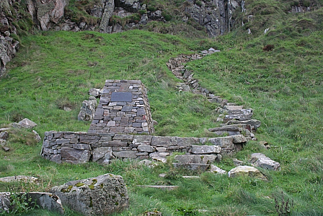
Start the walk on the eastern side of Cullen Harbour and then head east to Muckle Hythe and Logie Head. You continue past the Tony Hetherington's Memorial steps and the scenic beach at Sunnyside before arriving at the castle.
The castle sits in a wonderful position on a 50-foot (15 m)-high cliff overlooking the Moray Firth. It dates back to 13th century with the present remains largely from the 14th century.
To continue your walking in the area you could head west from Cullen on the Cullen to Portknockie Walk which follows a section of the epic Moray Coast Trail. There's lovely beaches and more interesting geology to enjoy on this section of the path.
Cullen to Findlater Castle Walk Ordnance Survey Map  - view and print off detailed OS map
Cullen to Findlater Castle Walk Open Street Map  - view and print off detailed map
Cullen to Findlater Castle Walk OS Map  - Mobile GPS OS Map with Location tracking
Cullen to Findlater Castle Walk Open Street Map  - Mobile GPS Map with Location tracking
Further Information and Other Local Ideas
To extend the walk you can continue east to visit Portsoy on the Portsoy To Cullen Coastal Walk. This fine cliff top path additionally visits the lovely secluded beach at the nearby Sandend Bay. In Portsoy you can also try the Portsoy Railway Walk. This short walk takes you along the old railway line to the Loch of Soy where there's some pleasant waterside footpaths.
Cycle Routes and Walking Routes Nearby
Photos
Findlater Castle 1. The horizontal masonry clinging to the side of the rock is what remains of Findlater Castle. The rock is 90 feet (27 metres) high and its summit is 50 feet (15 metres) lower than the nearby cliffs. Only pedestrians could enter the castle, and the access was defended by two bridges over gaps in the rock. The castle was in existence in 1455, when Sir Walter Ogilvy of Auchlevin was granted permission by King James II to add to and strengthen it. It passed briefly into the hands of the Gordons, and then returned to the Ogilvys, who finally abandoned it for the greater comfort of NJ5066 : Cullen House in the 17th century.
Another view of the precariously positioned Findlater Castle. The rock strata on which the castle stands are almost vertical. They have been folded by tectonic movements to the point that in some places they have been tilted beyond the vertical. This geological formation is the Findlater Flag Formation, named for the castle, and includes flaggy metamorphosed sandstones. Notice the sea surface, which is whipped up into a mass of white horses. The gales today were such that I was barely able to stand on the clifftop, and instantly abandoned as foolhardy my original plan of descending to the castle itself. There was so much sea spray that there were shifting rainbows all over the surface of the sea.


