Deep Hayes Country Park
![]()
![]() Explore 143 acres of woods, meadows, canals and pools in this pretty country park in Cheddleton, Staffordshire. There are a number of waymarked walking trails and a visitor centre where you can find more details.
Explore 143 acres of woods, meadows, canals and pools in this pretty country park in Cheddleton, Staffordshire. There are a number of waymarked walking trails and a visitor centre where you can find more details.
The site is great for wildlife watching and includes a bird hide where you can look out for the various winged visitors that frequent the park.
The park is located next to the Caldon Canal so you could follow the towpath into nearby Cheddleton as an extension of the walk. The Staffordshire Way also runs just past the park so this is another option if you have time.
Our Churnet Valley Walk runs through nearby Cheddleton and is a great way to further explore this lovely area.
Postcode
ST13 7JS - Please note: Postcode may be approximate for some rural locationsDeep Hayes Country Park Ordnance Survey Map  - view and print off detailed OS map
Deep Hayes Country Park Open Street Map  - view and print off detailed map
Deep Hayes Country Park OS Map  - Mobile GPS OS Map with Location tracking
Deep Hayes Country Park Open Street Map  - Mobile GPS Map with Location tracking
Dog Walking
The park is a nice place for a dog walk but you're advised to please keep them on leads.
Further Information and Other Local Ideas
If you follow footpaths and country lanes west from the park you can climb to Cats Edge and then descend to the pretty Stanley Pool where there's a fishery and sailing club. If you head east you can enjoy a ride on the Churnet Valley Railway at Cheddleton. The village houses the headquarters of the railway and includes an interesting museum. The Cheddleton Walk visits the park from the village, starting at the wonderful Flint Mill Museum which is well worth a visit.
Just east of Cheddleton there's the delightful Coombes Valley RSPB Nature Reserve. There's some lovely trails here through oak woodland and along the pretty Coombes Brook which runs through the reserve. There's also bird hides where you can look out for a variety of different species.
For more walking ideas in the area see the Staffordshire Walks page.
Cycle Routes and Walking Routes Nearby
Photos
Park Pool, Deep Hayes Country Park. This is the middle pool of the three main pools at Deep Hayes. It's a peaceful spot surrounded by woodland.
Visitor Centre. The park is a lovely area of pools, woodland and open areas. It is owned by Severn Trent Water and managed as a conservation area and park by Staffordshire County Council.
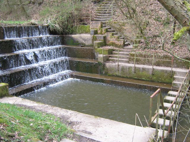
Upper weir and "stepping stones". This weir is between the upper pool (Haye Pool) and the middle pool (Park Pool). The concrete stepping stones enable walkers to do one of several circular walks around the country park.


