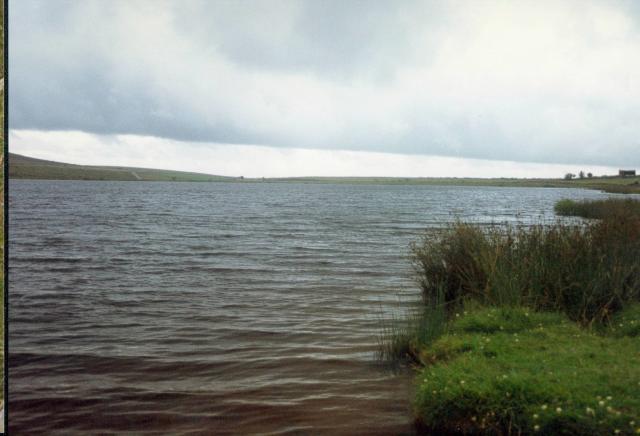
Dozmary Pool
![]()
![]() Visit the mysterious waters of the Dozmary Pool on this easy walk on Bodmin Moor.
Visit the mysterious waters of the Dozmary Pool on this easy walk on Bodmin Moor.
You can park at the car park at the southern end of Colliford Lake to start your walk. Then follow quiet country lanes north to the small lake. There's lovely views over to Colliford Lake on your left before coming to Dozmary Pool. Here you can look out for wildlife including curlew, dunlin and stonechat.
According to legend, the lake is where King Arthur rowed out to the Lady of the Lake and received the sword Excalibur.
To extend your walk head to Colliford Lake the largest lake in Cornwall. Here you can look out for more water loving birdlife and the Bodmin Ponies.
Dozmary Pool Ordnance Survey Map  - view and print off detailed OS map
Dozmary Pool Open Street Map  - view and print off detailed map
Dozmary Pool OS Map  - Mobile GPS OS Map with Location tracking
Dozmary Pool Open Street Map  - Mobile GPS Map with Location tracking
Pubs/Cafes
At the northern end of Colliford Lake there's the Colliford Tavern for refreshments. They do a nice cream tea which you can enjoy with fine views over the lake from the outdoor seating area. They also provide accommodation in the shape of a hotel and adjacent campsite. You can find it at a postcode of PL14 6PZ.
Further Information and Other Local Ideas
Head west and you could visit Blisland where you can pick up the Camelford Way, the Copper Trail and the popular Camel Trail which runs along a shared cycling and walking path. Here you'll also find the Blisland Inn, an award winning pub of some note, having been voted three times Cornwall CAMRA Pub of the Year and in 2001 becoming the campaign's national Pub of the Year. It's a fine place to visit if you are looking for a refreshing beverage after your walk.
Cycle Routes and Walking Routes Nearby
Photos
Highland cattle grazing near Colliford Lake. These fine beasts are grazing an area of rough access land on Colliford Downs just southeast of the lake. Beyond the gorse-covered field boundary, a hill of improved grass hides the southern end of the lake from view. Seen from the road up the eastern side of the lake.
Dozmary Pool. Allegedly the home of the Lady in the Lake of Arthurian Legend and also reputed to be bottomless.


