Eastbourne to Hastings Walk
![]()
![]() This walk heads from Eastbourne to Hastings along a lovely section of the East Sussex coast. The route runs for a distance of about 15 miles on a flat path. As such it's possible to complete in a day for fit walkers. On the way you'll pass Pevensey Bay and Bexhill with fine sea views and pretty beaches for most of the way.
This walk heads from Eastbourne to Hastings along a lovely section of the East Sussex coast. The route runs for a distance of about 15 miles on a flat path. As such it's possible to complete in a day for fit walkers. On the way you'll pass Pevensey Bay and Bexhill with fine sea views and pretty beaches for most of the way.
The walk starts at the pier at Eastbourne and heads north east to the pretty Sovereign Habour where there's lots of boats moored at a new development. You continue to Pevensey Bay, an attractive area which is also of some historical significance. It was here that William the Conqueror made the landing in his invasion of England in 1066 after crossing the English Channel from Normandy, France. There's a shingle beach here and two Martello towers, constructed in 1806 as Napoleonic coastal defences. Also look out for the ruins of the medieval Pevensey Castle and the 16th century Castle Inn.
The next section takes you past Norman's Bay to the town of Bexhill. It's worth enjoying a stroll around the town where there is some interesting Edwardian and Victorian architecture. On the seafront there's also the noteworthy De La Warr Pavilion. The Grade I listed building is a centre for contemporary art, having featured the work of Andy Warhol, Cerith Wyn Evans and sculptor Richard Wilson over the years.
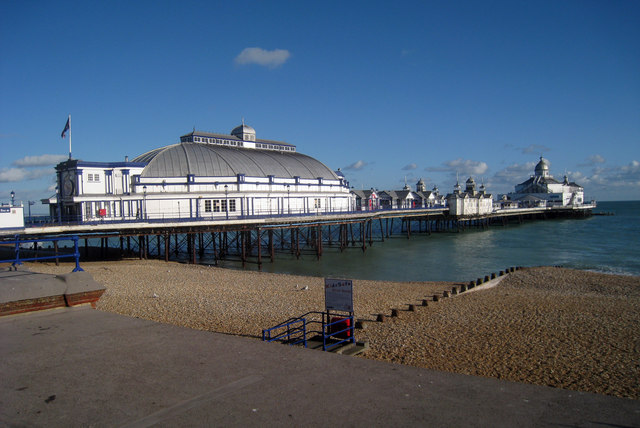
The final section of the route takes you from Bexhill to Hastings, passing Glyne Gap before finishing at the pier. Built in 1872 the pier was restored in 2017 and reopened to the public in the spring of 2019.
Postcode
BN21 3EL - Please note: Postcode may be approximate for some rural locationsEastbourne to Hastings Walk Ordnance Survey Map  - view and print off detailed OS map
Eastbourne to Hastings Walk Open Street Map  - view and print off detailed map
Eastbourne to Hastings Walk OS Map  - Mobile GPS OS Map with Location tracking
Eastbourne to Hastings Walk Open Street Map  - Mobile GPS Map with Location tracking
Pubs/Cafes
At Pevensey Bay consider stopping off at the historic Castle Inn. The inn dates all the way back to the 16th Century. It's recently been tastefully renovated, with its low ceilings and oak beams it retains its 'old world' pub charm. The pub has a large suntrap garden which is enjoyed by many during sunny weather. It's also dog friendly and a great place to stop at for refreshments on the route. You can find the inn at a postcode of BN24 6HS for your sat navs.
Further Information and Other Local Ideas
There is a direct train service between Eastbourne and Hastings run by Southern Rail. As such you can catch the train back at the end of the walk. The journey time is only about half an hour.
To continue your walking in the area you could pick up the 1066 Country Walk at Pevensey. The long distance waymarked trail commemorates the famous battle in 1066. There's also the Eastbourne to Alfriston Walk and Eastbourne to Beachy Head Walk to try from the town. At the other end of the route a visit to Hastings Country Park is recommended. The 600 acre park has miles of trail to explore with lots of interesting wildlife to look out for on the way. The park includes the village of Fairlight where there's some particularly fine cliff top walking in the Fire Hills section of the park.
As you approach Hastings you will pass St. Leonards Gardens where there's some lovely footpaths, an ornamental pond, herbaceous plants, shrubs, bulbs, formal flower beds and trees. There's also some interesting architecture with villas surrounding the gardens, in Regency Gothic and cottage styles. It's a very pleasant place for a stroll and can be found at postcode TN38 0HQ.
For more walking ideas in the area see the Sussex Walks page.
Cycle Routes and Walking Routes Nearby
Photos
Beach, Pevensey Bay. The tide is receding allowing the sand to be revealed below the shingle line whilst the sun tries to break through a small gap in the clouds. The South Downs can be seen on the horizon.


