Eridge Rocks
![]()
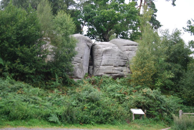
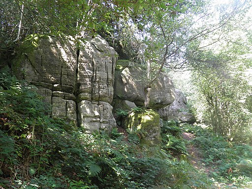
![]() This fascinating nature reserve in Tunbridge Wells contains a series of large boulders and mixed woodland. The imposing rocks are surrounded by interesting vegetation such as conifers, deciduous trees, bamboo, mosses, liverworts, ferns and bluebells. You can park at the car park at the southern edge of the reserve and then pick up the walking trails from there. Eridge Rail Station is also located nearby. You could catch the train and then follow National Cycle Route 21 for about a mile to reach the site.
This fascinating nature reserve in Tunbridge Wells contains a series of large boulders and mixed woodland. The imposing rocks are surrounded by interesting vegetation such as conifers, deciduous trees, bamboo, mosses, liverworts, ferns and bluebells. You can park at the car park at the southern edge of the reserve and then pick up the walking trails from there. Eridge Rail Station is also located nearby. You could catch the train and then follow National Cycle Route 21 for about a mile to reach the site.
The Tunbridge Wells Circular Walk passes the site so you can pick this up to extend your walk. The long distance trail takes you through the attractive countryside surrounding the town and includes a visit to Harrison's Rocks. Just to the north is the RSPB Broadwater Warren. It's a great place to continue your walk with its nature trails, wet woodland, boardwalk, ponds and wide variety of wildlife.
Postcode
TN3 9JG - Please note: Postcode may be approximate for some rural locationsEridge Rocks Ordnance Survey Map  - view and print off detailed OS map
Eridge Rocks Open Street Map  - view and print off detailed map
Eridge Rocks OS Map  - Mobile GPS OS Map with Location tracking
Eridge Rocks Open Street Map  - Mobile GPS Map with Location tracking
Pubs/Cafes
Head to the Nevill Crest and Gun at Eridge Green for some post walk refershments. It's a pub of some note being housed in a building with over 500 years of history. The unusually named inn is named after the crest of the Nevill family, the Earls of Abergavenny, on whose estate the pub was built: it is their monogram that adorns the building and many others in the surrounding area. The 'Gun' part of the name arose from a forge on the estate which produced cannons and cannon balls for the Nevilles: at one time an ancient cannon, made of strips of metal held together with hoops, was fired on fair days or days of celebration, and it is this that is referred to in the name. Many of the local villagers would have been employed in the forge. The pub has a splendid interior with atmospheric, beamed rooms and roaring fires along with a lighter garden room. Outside there's a large garden area where you can relax on finer days.


Pictured above: The Nevill Crest and Gun pub. An ideal pit stop on the walk.
Dog Walking
There's some nice woodland trails in the reserve which are great for a dog walk. Please keep them under control though as there is a lot of wildlife in the area. The Nevill Crest and Gun pub mentioned above is also dog friendly.
Further Information and Other Local Ideas
To the south is the neighbouring village of Rotherfield where there are some nice trails across the Rotherfield Millennium Green. The green includes a pond, a stream, grassland, an ancient oak, a heritage orchard and lots of wildlife. In the village you can also visit the Grade I listed 11th century church and a 17th century pub with a particularly fine garden area.
Just west of Tunbridge Wells there's the High Rocks National Monument. It's a fantastic spot with a series of huge sandstone rocks and some lovely wooded areas to explore. There's also a picnic area and a great pub to visit here.
Cycle Routes and Walking Routes Nearby
Photos
Eridge Rocks. A popular location for walking & rock climbing. These rocks are outcrops of Tunbridge Wells Sandstone


