Eton Walks
![]()
![]() This Berkshire based town is a fine place to start a walk with two rivers, a local lake and the iconic Eton College to explore.
This Berkshire based town is a fine place to start a walk with two rivers, a local lake and the iconic Eton College to explore.
This riverside circular walk from the village visits Eton Wick, the River Thames Path, Dorney Lake, the Jubilee River and the famous Eton College. The college dates back to the 15th century when it was founded by Henry VI. Eton is one of the most prestigious institutions in the world due to its history, wealth, and notable alumni.
The walk start from the riverside train station where you can pick up the Thames Path National Trail and follow it west along the river to Eton Wick.
The route continues west along the Boveney Ditch and the Cree Brook on Dorney Common before turning north west along Dorney Lake. The lake was used as the rowing venue for the 2012 Olympics in London.
You continue through Dorney, passing Dorney Court before picking up the Jubilee River Path. Follow this east past Chalvey on the outskirts of Slough before coming to Agars Plough. You can turn south west along the school playing fields before passing the historic Eton College and returning to the train station.
Postcode
SL4 1QG - Please note: Postcode may be approximate for some rural locationsEton Ordnance Survey Map  - view and print off detailed OS map
Eton Open Street Map  - view and print off detailed map
Eton OS Map  - Mobile GPS OS Map with Location tracking
Eton Open Street Map  - Mobile GPS Map with Location tracking
Walks near Eton
- Thames Path - Starting at the Source of the Thames at Thames Head in Gloucestershire, follow the iconic river through beautiful countryside and historic towns to the city of London.
- Dorney Lake - This purpose-built rowing lake in Buckinghamshire has a traffic free National Cycle Network trail running past it on one side and the Thames Path on the other
- Jubilee River - Follow the Jubilee River path from Maidenhead to Eton and Slough on this waterside walk or cycle on the border of Berkshire and Buckinghamshire
- Windsor Great Park - A circular cycle or walk around the beautiful Windsor Great Park in Surrey
- Maidenhead Boundary Walk - This circular walk takes you around the old boundary of Maidenhead
- The Long Walk Windsor Castle - This route in Windsor Great Park takes you along the famous 'Long Walk' to Windsor Castle
- Maidenhead - This walk takes you from Maidenhead to Windsor along the Thames Path National Trail
- Langley Park Country Park - Langley Park has a variety of beautiful trails suitable for cycling and walking
- Black Park Country Park - With over 10 miles of well signed cycling and walking tracks, Black Park is the ideal place for a great day out in the country
Pubs/Cafes
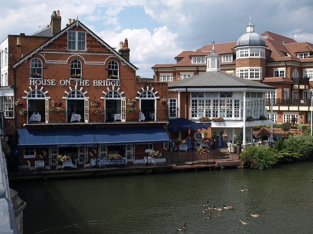
The Cote is a nice choice for some post walk refreshment. The brasserie is located in a lovely spot by the river, next to The Eton Walkway bridge which crosses the Thames near the train station. There's outdoor seating where you can relax and enjoy a bite to eat with a view of the river.
Further Information and Other Local Ideas
To continue your walking in the area you could visit the expansive Windsor Great Park and the The Long Walk at Windsor Castle. You could also continue along the river path to visit Maidenhead.
Across the river to the north in Buckinghamshire there's two fine country parks in the shape of Black Park Country Park and Langley Park Country Park. There's miles of good cycling and walking trails through the woodland in these parks. Langley Park's rhododendron gardens and Arboretum are also particularly lovely.
For more walking ideas in the area see the Berkshire Walks page.
Photos
Eton Wick: Confluence of Roundmoor Ditch with Cress Brook Roundmoor Ditch, on the left, joins with Cress Brook, on the right, here to form Boveney Ditch. Although these watercourses are known as "Ditches" they are large enough in terms of width and depth to be bigger than many so-called rivers. Eagle-eyed viewers will spot the heron, and the faint wisp of steam coming off the surface of Roundmoor Ditch caused by the air temperature being much lower than the water temperature.


