Around Folkestone's Coastal Parks Walk
![]()
![]() This coastal walk from Folkestone takes you to three of the area's country parks.
This coastal walk from Folkestone takes you to three of the area's country parks.
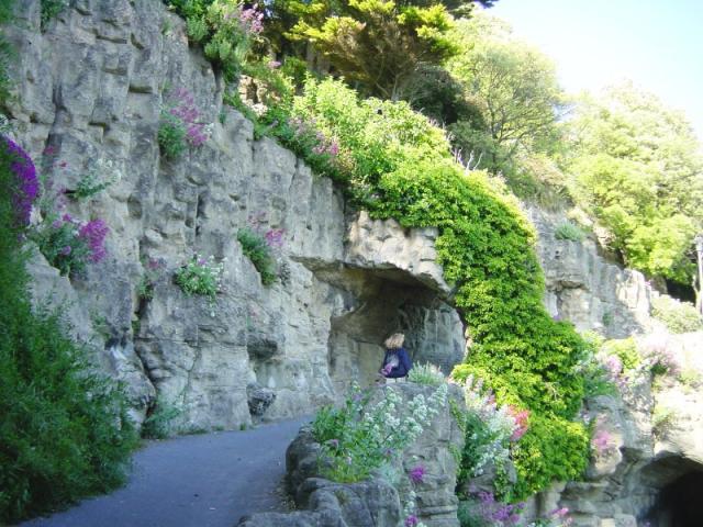
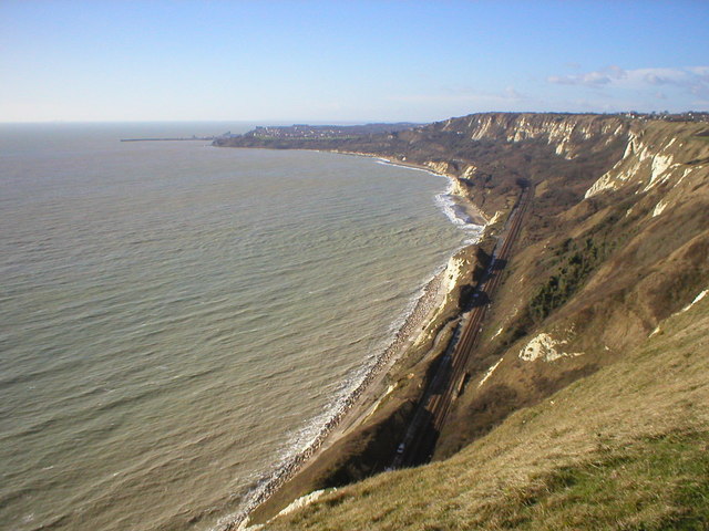
The walk starts on the front at Lower Leas Coastal Park. The park includes a number of interesting features including imposing cliffs, interesting rock formations, an amphitheatre, a great zig-zag path, wildflower meadows and lots in intersting plants and flowers. From the park you head east past the Harbour Pier, the Martello Tower and Dover Hill, where you pick up the Saxon Shore Way. Continue east and it will take you to East Cliff and Warren Country Park. In the park there's some wonderful coastal views, spectacular cliffs, interesting flora and fauna and three old Martello Towers to see. These were built on the east cliffs in the early 19th century to protect against the French invasion of Napoleon.
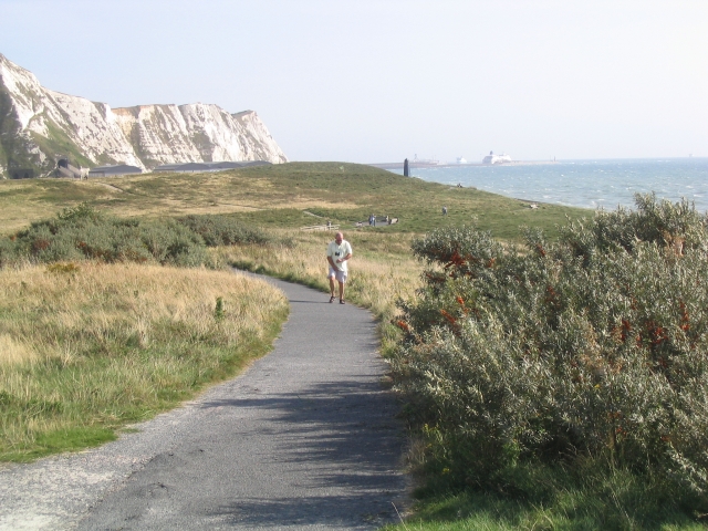
The route continues east along Tunnel Abbot's Cliff to Samphire Hoe Country Park. From the park there are fabulous views of the stunning Shakespeare Cliff and the Strait of Dover. The park is also a designated Nature Reserve with a huge variety of wildlife and a number of nationally rare plant species including the Early Spider Orchid.
To continue your walking in the area head east to Dover and visit the fascinating Dover Castle. Near here you can also pick up our circular Dover Cliffs Walk which will take you along the famous White Cliffs.
Folkestone Ordnance Survey Map  - view and print off detailed OS map
Folkestone Open Street Map  - view and print off detailed map
Folkestone OS Map  - Mobile GPS OS Map with Location tracking
Folkestone Open Street Map  - Mobile GPS Map with Location tracking
Walks near Folkestone
- East Cliff and Warren Country Park - Enjoy the spectacular East Cliffs of Folkestone, the sandy beaches of East Wear Bay and the Warren nature reserve on this circular walk.
The attractive park is formed of the East Cliffs of Folkestone, the sandy beaches of East Wear Bay and the land-slipped nature reserve land between the cliffs and the sea - Samphire Hoe Country Park - This coastal country park is located near Dover on the Kent coast
- North Downs Way - This beautiful trail starts in Farnham, Surrey and heads east through the stunning North Downs to the historic city of Canterbury in Kent
- Saxon Shore Way - Explore Kent's ancient coastline as you visit Iron Age hill forts, cathedrals, Martello towers, historic ports and castles on this incredible 160 mile walk
- Lower Leas Coastal Park - This coastal country park is located in Folkestone and has fabulous views over the Kent coastline
- Dover White Cliffs Walk - Enjoy a circular walk along the iconic White Cliffs of Dover on this route along the Kent Coast
- Dover Castle - Explore the grounds of the largest castle in England and enjoy fabulous views of the White Cliffs of Dover
- Peene Quarry Country Park - A short circular walk around Peene Quarry in the North Downs
- Lympne - This circular walk around the Kent village of Lympne visits Lympne Castle and the Royal Military Canal Path
- Brockhill Country Park - Brockhill Park has a number of waymarked woodland trails, a lake, open grassland and meadows
- Royal Military Canal Path - This walking route runs from Pett Level to Seabrook along the Royal Military Canal
- Hythe - This long circular walk explores the countryside around the Kent town of Hythe
- Lyminge - This Kent based village is located just north of the coast, near Folkestone
- Alkham Valley - This walk explores the countryside surrounding the village of Alkham in Kent
Further Information and Other Local Ideas
Just to the north of the town you can enjoy a climb to Peene Quarry and the Folkestone White Horse. There's fine views over the Channel Tunnel Terminal and the coast from this viewpoint. Near here there's also the worthy village of Lyminge where you will find an ancient 10th century church and access to the popular Elham Valley Way.
To the north east there's the Alkham Valley where you'll find an Area of Outstanding Natural Beauty. The valley includes some fine footpaths and two significant historical sites including the ruins of St Radigund's Abbey and the 11th century St Peter's Church. There's also a fine local pub in the pretty village of Alkham here.
At the eastern end of the valley you could visit the noteworthy Kearsney Abbey. There's some beautiful gardens here with ornamental lakes and views of the River Dour the highlights.
For more walking ideas in the area see the Kent Walks and the North Downs Walks pages.
Photos
The Amphitheatre, Lower Leas Coastal Park, Folkestone. Viewed from the Zig Zag path. Shepway District Council organises a programme of free events here during the summer months.
East Cliffs and Warren Country Park. This rough ground is above East Wear Bay, close to Martello Tower No.3. A path leads through this to the beach down on the Bay.


