Fulking Circular Walk
![]()
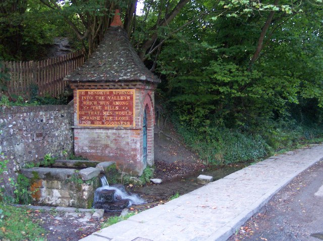
![]() The pretty village of Fulking sits in a lovely position on the South Downs. In the village there's picturesque cottages and a natural spring and fountain which was installed in 1886. Henry Willett, a wealthy brewer from Brighton, and the famous painter and art critic John Ruskin are usually credited with devising and instigating the water supply scheme.
The pretty village of Fulking sits in a lovely position on the South Downs. In the village there's picturesque cottages and a natural spring and fountain which was installed in 1886. Henry Willett, a wealthy brewer from Brighton, and the famous painter and art critic John Ruskin are usually credited with devising and instigating the water supply scheme.
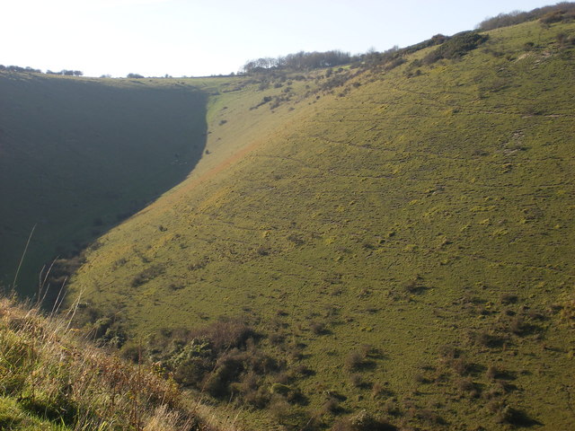
This circular walk from the village visits one of the highlights of the area at the Devils Dyke. Here you'll find a photogenic dry valley with an Iron Age Hill Fort and stunning views across the South Downs.
The walk starts from the village and follows public paths and a section of The South Downs Way to the Devil's Dyke, passing Fulking Hill on the way. The route explores the site before returning to the village on alternative paths. You can take a slight detour from the route to visit the village of Poynings if you have time.
Fulking Ordnance Survey Map  - view and print off detailed OS map
Fulking Open Street Map  - view and print off detailed map
Fulking OS Map  - Mobile GPS OS Map with Location tracking
Fulking Open Street Map  - Mobile GPS Map with Location tracking
Pubs/Cafes
The Shepherd and Dog in Fulking is a fine place for some post walk refreshments. The pub dates back to the early 1800s and includes a charming old interior with low beams. Outside there's a lovely garden area with a pretty stream running through it. You can find the pub at postcode BN5 9LU for your sat navs. The car park here makes a nice start point for the walk.
Dog Walking
The area is great for dog walking and the Shepherd and Dog pub mentioned above is also very dog friendly. They run dog walks on the first Saturday of every month too.
Further Information and Other Local Ideas
To extend your walking around the village head west along the National Trust's Fulking Escarpment to Edburton Hill and Truleigh Hill.
Head north east and you can visit Pyecombe and Wolstonbury Hill. This area of chalk grassland is covered in lovely wildflowers during the summer months.
To continue your walking in the area see the South Downs Walks page.
Cycle Routes and Walking Routes Nearby
Photos
The Spring at Fulking. One of a string of villages dotted along the spring line at the bottom of the South Downs spring line. "He sendeth springs into the valleys which run among the hills. Oh that men would praise the Lord for His goodness". The other small plaque above the spout warns potential consumers of the water's unsuitability.
Bridleway to Fulking. A terraceway linking the Downs with the village below between Perching and Fulking Hills. Newtimber then Wolstonbury Hills are in the background.
Fulking escarpment and spring line. The view that has launched a thousand calendars. Seen from Newtimber's north hill the spring line settlements at the base of the Downs can be seen.
Devils Dyke Pub. A popular spot for Brightonians since the 19th century. There has been a refreshment building of one sort or another since 1818, the first hotel arrived in 1831, was rebuilt in 1871 and burnt down in 1945. The current rather non-descript building has been there since 1955. The open top bus is the number 77 which regularly runs services over the weekend from the Pier to the Dyke.


