Glamorgan Ridgeway Walk
![]()
![]() Follow the Glamorgan Ridgeway from Margam Country Park, near Port Talbot, through beautiful upland and valley scenery, to Caerphilly Castle. There are fabulous panoramic views of the Brecon Beacons to the north, the Bristol Channel and Devon and Somerset to the south.
Follow the Glamorgan Ridgeway from Margam Country Park, near Port Talbot, through beautiful upland and valley scenery, to Caerphilly Castle. There are fabulous panoramic views of the Brecon Beacons to the north, the Bristol Channel and Devon and Somerset to the south.
The walk begins at the splendid Margam Country Park (video below). The attraction includes the magnificent Margam Castle, an 18th Century Orangery with ornamental gardens and the Deer Park, all set within 1000 acres of beautiful countryside. From Margam you begin by heading east to Bettws and Blackmill. You then pass through Llantrisant forest, Llantrisant, Garth Hill and Caerphilly Common. From Garth Hill there are fine views of Cardiff and the Taff valley. It is thought to be the inspiration for 'Ffynnon Garw', the fictional mountain (or hill) featured in the book, and film, The Englishman Who Went Up a Hill But Came Down a Mountain. The walk also passes near to Taff's Well - the only thermal spring in Wales located in Taff's Well park. You also climb Caerphilly Mountain with more tremendous views to enjoy as shown in the latter part of the video below.
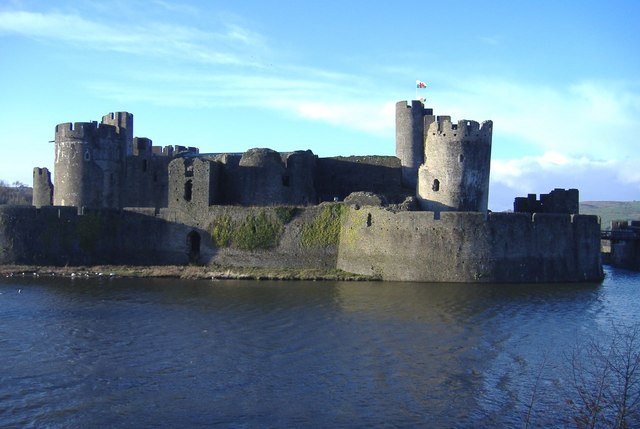
The final section descends into Caerphilly, finishing near the castle.
Please click here for more information
Glamorgan Ridgeway Walk Ordnance Survey Map  - view and print off detailed OS map
Glamorgan Ridgeway Walk Open Street Map  - view and print off detailed map
Glamorgan Ridgeway Walk OS Map  - Mobile GPS OS Map with Location tracking
Glamorgan Ridgeway Walk Open Street Map  - Mobile GPS Map with Location tracking
Further Information and Other Local Ideas
At the start of the route in Margam you could follow a footpath north to visit Brombil Reservoir. The picturesque turquiose coloured lake is a lovely place for a peaceful stroll. From the hills surrounding the lake there are fine views to the coast too. You can find the site just a mile north of the route start point in Margam Country Park.
Cycle Routes and Walking Routes Nearby
Photos
Margam Castle in the country park at the start of the route. The imposing and reputedly haunted castle, built between the years 1830 and 1840 for the Talbot family, is situated at the heart of Margam Country Park. This Tudor Gothic grade 1 listed mansion was featured by William Henry Fox Talbot in some of his calotype photographs, which were among the earliest photographs taken in Wales.
Caerphilly Common Trig Point. Overlooking Caerphilly with the castle just visible over the brow of the foreground to the left of the pillar. At the top left of the view the Rhymney Valley goes away into the distance.
Elevation Profile


