Glazebrook Trail
![]()
![]() This easy trail follows Glaze Brook from Pennington to Cadishead.
This easy trail follows Glaze Brook from Pennington to Cadishead.
The trail starts in the lovely Pennington Flash Country Park in Leigh. This nature reserve has a 173 acre lake and is home to a variety of birdlife. You then follow Glaze Brook and Pennington Brook south to Glazebury and then onto Cadishead on the Manchester Ship Canal.
The waymarked walk runs for just under 9 miles, along a flat, easy path so it's suitable for most abilities.
Please click here for more information
Glazebrook Trail Ordnance Survey Map  - view and print off detailed OS map
Glazebrook Trail Open Street Map  - view and print off detailed map
Glazebrook Trail OS Map  - Mobile GPS OS Map with Location tracking
Glazebrook Trail Open Street Map  - Mobile GPS Map with Location tracking
Further Information and Other Local Ideas
From north of Pennington Flash you can pick up the Leeds and Liverpool Canal and follow it north west to Wigan Flashes Nature reserve where there are more birdwatching opportunities. You could also pick up the Wigan Canal Walk and further explore the area around the town.
At the other end of the route near the Manchester Ship Canal you can pay a visit to Lymm Dam.
The waymarked Salford Trail can be picked up nearby. The circular trail visits some of the highlights of the area including the picturesque Salford Quays with its shops, museums and theatres.
For more walking ideas in the area see the Greater Manchester Walks page.
Cycle Routes and Walking Routes Nearby
Photos
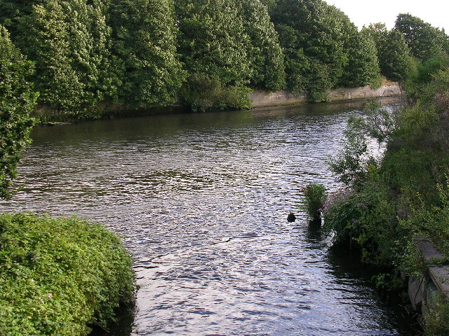
Glaze Brook (also known as the River Glaze) looking downstream from Pennington Bridge, which carries the East Lancashire Road (A580) over the brook. The brook is now making its way across the western edge of Chat Moss. Prior to this point the brook is known as Pennington Brook. The source of the brook being Pennington Flash, a lake formed by mining subsidence near Leigh.
Footbridge over the brook. This bridge connects Cadishead, in Salford, with Glazebrook, Warrington
Taken from SJ687936, looking upstream(N). The Glaze Brook, or River Glaze, wends its way across the mosslands between Manchester and Warrington. In this picture Great Woolden Moss lies to the right of the brook and Holcroft Moss to the left. Both Mosses being part of the larger Chat Moss.
Glaze Brook enters the Manchester Ship Canal. Here, on the border between Cheshire and Salford, the Manchester Ship Canal receives the waters of Glaze Brook (also known as the River Glaze). The Glaze drains a substantial area of mossland hereabouts and was the boundary between the ancient Lancashire Hundreds of West Derby and Salford.This latter fact is recorded on the wall of a bridge near here that carries the A57 road over the Glaze, but as the wall is made of sandstone the lettering is wearing away.This part of the Ship Canal is a canalised section of the River Mersey. The Mersey joined the canal a little way upstream of this point (to the left) and will leave the canal a little further downstream, close to where the River Bollin joins the canal.
Elevation Profile


