Greenwich Park Walking and Cycling
![]()
![]() Enjoy a cycle or walk through this large park in London. There's 180 acres of wide lawns, tree lined avenues, orchards and pretty gardens. There's also a beautiful 200m long herbaceous border and a deer park with Red and Fallow Deer. You can climb to the park's high points for great views of the River Thames, Canary Wharf, the Isle of Dogs and the City of London. The park also houses The Royal Observatory, the home of Greenwich Mean Time, the Prime Meridian and London's only Planetarium. The observatory played a major role in the history of astronomy and navigation.
Enjoy a cycle or walk through this large park in London. There's 180 acres of wide lawns, tree lined avenues, orchards and pretty gardens. There's also a beautiful 200m long herbaceous border and a deer park with Red and Fallow Deer. You can climb to the park's high points for great views of the River Thames, Canary Wharf, the Isle of Dogs and the City of London. The park also houses The Royal Observatory, the home of Greenwich Mean Time, the Prime Meridian and London's only Planetarium. The observatory played a major role in the history of astronomy and navigation.
This circular route around the park is designed for walkers but you can cycle along The Avenue and Blackheath Avenue through the park. You can extend your cycle by heading to the River Thames and picking up National Cycle Route 1. Quietway 1 also starts from Greenwich. The Jubilee Greenway passes along the Thames to the north of the park. The 60km waymarked trail takes you on a tour of the capital's finest parks and most famous landmarks.
At the Cutty Sark you can pick up the Waterlink Way which takes you south along riverside paths to Beckenham. From here you can also follow the Thames Path east and visit the famous Millennium Dome.
You can virtually explore the park using the google street view link below!
Postcode
SE10 8XJ - Please note: Postcode may be approximate for some rural locationsPlease click here for more information
Greenwich Park Ordnance Survey Map  - view and print off detailed OS map
Greenwich Park Open Street Map  - view and print off detailed map
Greenwich Park OS Map  - Mobile GPS OS Map with Location tracking
Greenwich Park Open Street Map  - Mobile GPS Map with Location tracking
Explore the Area with Google Street View 
Pubs/Cafes
Head to the recently refurbished Pavilion Café for some refreshments after your exercise. You can find it in a fine location at the top of the hill by the Royal Observatory. Built in 1906 the octagonal building is topped by a dove-cot with a weather vane showing Nelson looking through his telescope. In fine weather make the most of the large garden at the front and rear. There's a good menu which includes freshly made stone-baked pizzas, soup, sandwiches and hearty hot dishes.
Further Information and Other Local Ideas
The epic Green London Way passes through the area. The long distance circular walk visits the best and most beautiful of London's open spaces.
For more walking ideas in the area see the London Walks page.
Cycle Routes and Walking Routes Nearby
Photos
The bandstand in Greenwich Park Well looked after, as befits a Royal Park, with concerts every weekend in the summer.
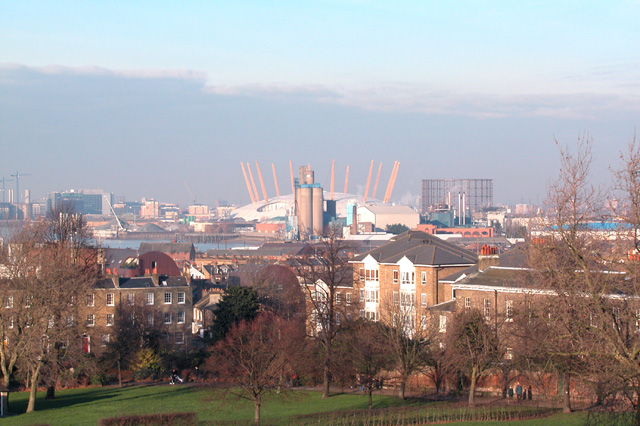
The Thames from Greenwich Park. Not the better known view from the Observatory, but a fine one nevertheless. From just near the Westcombe Park Road gate, the view is along the Blackwall Reach of the Thames, with Canary Wharf on the left and the O2 on the right. The brick building with the chimneys, in front of Canary Wharf, is the old Greenwich Power Station which used to be a back up to the London Underground.
Up and over - cycle barrier in Greenwich Park This is just inside the Vanbrugh Gate of the park, where a new 'kissing gate' style cycle barrier had just been introduced. Cycling is permitted on the principal roads through the park but cyclists are supposed to dismount at the narrow gate onto Maze Hill. The new barrier achieved that aim but made matters difficult for cyclists, mothers with prams etc. It was removed after a few weeks following complaints by users.


