Greyfield Woods
![]()
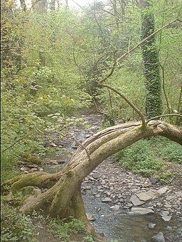
![]() These pretty woods near the village of High Littleton have some nice woodland trails to try. There's free car parking and in the spring there's lots of bluebells within the ancient, mixed woodland. There's also a lovely waterfall and the option of picking up the Limestone Link which skirts the southern edge of the woods. You could pick up this long distance trail and head towards Clutton, Temple Cloud or Timsbury. In nearby Clutton you can join with the Three Peaks Walk and further explore the beautiful Chew Valley. Heading west will take you to the splendid Chew Valley Lake.
These pretty woods near the village of High Littleton have some nice woodland trails to try. There's free car parking and in the spring there's lots of bluebells within the ancient, mixed woodland. There's also a lovely waterfall and the option of picking up the Limestone Link which skirts the southern edge of the woods. You could pick up this long distance trail and head towards Clutton, Temple Cloud or Timsbury. In nearby Clutton you can join with the Three Peaks Walk and further explore the beautiful Chew Valley. Heading west will take you to the splendid Chew Valley Lake.
Greyfield Woods are located not far from both Bristol and Bath.
Postcode
BS39 6YE - Please note: Postcode may be approximate for some rural locationsGreyfield Woods Ordnance Survey Map  - view and print off detailed OS map
Greyfield Woods Open Street Map  - view and print off detailed map
Greyfield Woods OS Map  - Mobile GPS OS Map with Location tracking
Greyfield Woods Open Street Map  - Mobile GPS Map with Location tracking
Pubs/Cafes
Head east into High Littleton and you could enjoy some post walk refreshment at the Star Inn. The attractive stone pub does good pub grub and also has a nice garden area if the sun is shinging. You can find them on the High Street at postcode BS39 6HX for your sat navs.
Dog Walking
As you'd expect the woodland trails are ideal for dog walking so you'll probably see other owners on your visit. The Star Inn mentioned above is also dog friendly.
Further Information and Other Local Ideas
In the nearby village of Clutton you can join with the Three Peaks Walk and explore the beautiful Chew Valley. Heading west along the trail will take you to the popular Chew Valley Lake with the pretty Litton Reservoir also in this area.
Just to the south there's the attractive town of Midsomer Norton where there's nice trails along the River Somer in the town centre.
You can reach the woods from the nearby village of Paulton by following the Limestone Link. The village has a couple of nice pubs to relax in. The circular Timsbury Walk also visits the woods from the nearby village.
For more walking ideas in the area see the Somerset Walks page.


