Hackney Marshes Walks
![]()
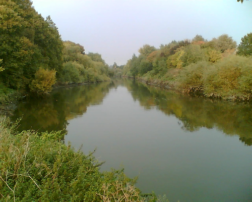
![]() This circular walk explores the rivers, woods and nature reserves in the Hackney area of East London. There's nice waterside footpaths to follow along the River Lea and the Lea Canal. You'll also visit the Middlesex Filter Beds Nature Reserve at the northern end of Hackney Marshes. At the southern end there are woodland trails through the Wick Community Woodland. Along the way there's good views towards the West End, City and Canary Wharf.
This circular walk explores the rivers, woods and nature reserves in the Hackney area of East London. There's nice waterside footpaths to follow along the River Lea and the Lea Canal. You'll also visit the Middlesex Filter Beds Nature Reserve at the northern end of Hackney Marshes. At the southern end there are woodland trails through the Wick Community Woodland. Along the way there's good views towards the West End, City and Canary Wharf.
The walk starts from the car park off Homerton Road at South Marsh. From here you can pick up the waterside path along the River Lea to North Marsh and the Middlesex Filter Beds Nature Reserve. Here the route turns left and picks up the towpath along the Lea Canal and the Hackney Cut. This leads to the Wick Woodland where you turn left and follow the woodland trails for about a quarter of a mile. Look out for woodland birds and a variety of interesting plants and trees in this area. After leaving the woods you pick up the River Lea again to take you back to the car park.
The marshes are located next to the Olympic Park which has good cycling and walking trails in over 500 acres of parkland, waterways, playgrounds and cafes. It's a great place to extend your walk if you have time.
Also nearby is Victoria Park with lakes and cycle and walking paths set in 200 acres of parkland. Our Hackney Canal Walk explores the park and the adjacent canals.
This route uses a section of the Lea Valley Walk. You could follow the river north west to and visit Tottenham Marshes, Walthamstow Marshes and the Walthamstow Reservoirs where there are some good waterside cycling and walking trails.
The Capital Ring and Jubilee Greenway long distance trails also run through the area.
Postcode
E9 5PF - Please note: Postcode may be approximate for some rural locationsHackney Marshes Ordnance Survey Map  - view and print off detailed OS map
Hackney Marshes Open Street Map  - view and print off detailed map
Hackney Marshes OS Map  - Mobile GPS OS Map with Location tracking
Hackney Marshes Open Street Map  - Mobile GPS Map with Location tracking
Pubs/Cafes
The Princess of Wales is in a great location right next to the canal. There's an outdoor terrace where you can enjoy a meal with lovely views. It's a great place to relax if the weather is fine. You can find the pub at the northern end of the marshes at 146 Lea Bridge Road with a postcode of E5 9RB for your sat navs.
Dog Walking
The marshes are a popular place for dog walkers so you'll probably bump into a few other owners on your walk. The Princess of Wales pub mentioned above is also dog friendly.
Further Information and Other Local Ideas
Just to the west of the marshes you'll find the pretty Finsbury Park where's there's attractive gardens and lakeside trails. Here you can also pick up the popular Parkland Walk. The walk follows the course of an old railway line running between Finsbury Park and Alexandra Park. The whole route is actually a local nature reserve and a great place to see interesting flora and fauna in the city.
Cycling information: National Cycle Route 1 runs along a traffic free path on the western side of the marshes, next to the river. It can be followed south through Hackney to the Hereford Union Canal and Victoria Park.
Cycle Routes and Walking Routes Nearby
Photos
Former Factory, Homerton, London E9. This view is looking north at the Homerton Road bridge over the Lee Navigation, with the former Lesney Matchbox toy factory beyond. The towpath on the right has been recently renovated to provide an enjoyable route for pedestrians and cyclists along the Lea Valley.


