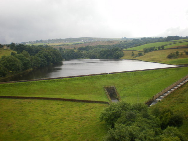
Harden Beck
![]()
![]() This circular walk from the West Yorkshire village of Harden takes you along the Harden Beck to two of the area's highlights at Goit Stock Waterfall and Hewenden Reservoir.
This circular walk from the West Yorkshire village of Harden takes you along the Harden Beck to two of the area's highlights at Goit Stock Waterfall and Hewenden Reservoir.
The walk starts in the village and follows a road south to meet up with the beck. You can then pick up a footpath heading west past the old Mill to Crag Wood and Goit Stock Waterfall. It's a lovely spot with the picturesque falls tucked away in a delightful grotto.
The route then picks up the Bradford Millennium Way and
continues past the impressive Hewenden Viaduct before coming to Hewenden Reservoir and Gleid Hill. You can then follow trails around the reservoir to Buck Park. The route then heads north, passing Hallas Hall Farm before returning to the village.
You can extend the walk by continuing south to visit Doe Park Reservoir, home to Doe Park Water Activities Centre where you can try a variety of water based activities.
Postcode
BD16 1BG - Please note: Postcode may be approximate for some rural locationsHarden Beck Ordnance Survey Map  - view and print off detailed OS map
Harden Beck Open Street Map  - view and print off detailed map
Harden Beck OS Map  - Mobile GPS OS Map with Location tracking
Harden Beck Open Street Map  - Mobile GPS Map with Location tracking
Pubs/Cafes
Back in the village head to The Malt for some well earned refreshments after your walk. There's a splendid large garden area which seats 130 people. It's a great spot to relax in on a fine summer afternoon. The building also has an interesting history, dating back to 1550. It has taken on many faces, including a court room and a prison, of which the famous cell room still exists. A new Orangery has also been added, seating 33 people. Inside there's a cosy interior with three open fires for cold winter days. They do great food and have a large car park so the inn can make for an alternative start point for the walk. You can find it on the Wilsden Road with a postcode of BD16 1BG for your sat navs.
Further Information and Other Local Ideas
For more walking ideas in the area see the South Pennines Walks page.


