Hewenden Reservoir and Cullingworth Viaduct Walk
![]()
![]() This circular walk in Cullingworth takes you to Hewenden Reservoir and Viaduct.
This circular walk in Cullingworth takes you to Hewenden Reservoir and Viaduct.
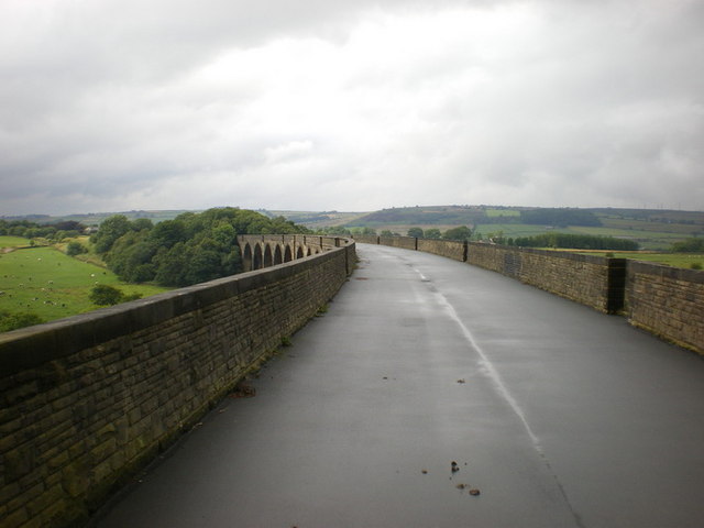
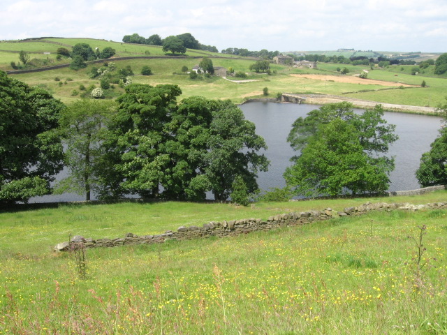
Start the walk from Cullingworth Gate where you can pick up a dismantled railway line and follow it south east toward the viaduct. The impressive structure opened to passenger trains in 1883 and originally formed part of the Keighley and Thornton Branch of the Great Northern Railway. It stands at a height of 123 feet (37 m) and spans 576 yards (527 m) with 17 arches each of 16.5 yards (15 m). You can now cross the viaduct on a shared cycling and walking path. From the elevated position there are splendid views back down to the reservoir and over the surrounding countryside. Other footpaths will then take you around the water before returning to the village.
To continue your walking in the area head north to visit the lovely Goit Stock Waterfall. You can reach the secluded falls by following public footpaths north from the reservoir into Goit Stock Wood. The circular Harden Beck Walk starts from the nearby village of Harden and visits the falls before heading to the reservoir. The historic village is worth a visit with a fine mid 16th century pub to invesitgate.
Follow the Bradford Millennium Way south and you will soon come to Doe Park Reservoir, home to Doe Park Water Activities Centre where you can try a variety of water based activities.
Hewenden Reservoir and Viaduct Ordnance Survey Map  - view and print off detailed OS map
Hewenden Reservoir and Viaduct Open Street Map  - view and print off detailed map
Hewenden Reservoir and Viaduct OS Map  - Mobile GPS OS Map with Location tracking
Hewenden Reservoir and Viaduct Open Street Map  - Mobile GPS Map with Location tracking
Further Information and Other Local Ideas
For a similar walk in the area head south and try the Thornton Viaduct Walk. This structure was part of the GNR's Queensbury Lines running between Queensbury and Keighley. You can now walk or cycle to the top for fine views over the area. Both viaducts also form part of the Great Northern Railway Trail which runs from Queensbury to Cullingworth.
For more walking ideas in the area see the Yorkshire Dales Walks and the Nidderdale Walks pages.
Cycle Routes and Walking Routes Nearby
Photos
Hewenden Viaduct. Viaduct across the Hewenden Beck valley on the dismantled railway line southeast of Cullingworth, looking north from the Millennium Way near the northeast corner of Hewenden Reservoir.
Hewenden Viaduct. One of the viaducts on the long-closed former Great Northern route from Queensbury to Keighley, but recently opened to cyclists and pedestrians as part of the National Cycle Network. Viewed from near East Manywells Farm
Hewenden Reservoir Dam, Cullingworth. This is taken from the footpath high above the western side of the reservoir. In the background is yet another view of Hewenden Viaduct, now part of a Sustrans cycle path..


