Headcorn Walks
![]()
![]() This historic village is located in the Low Weald area of Kent, a few miles south of Sutton Valence.
This historic village is located in the Low Weald area of Kent, a few miles south of Sutton Valence.
This circular walk starts from the train station in the village and explores the area to the south of the settlement. On the way you will enjoy views of the surrounding countryside and the River Beult. The route runs for just over 2 miles, using public footpaths running through the area. Also look out for the photogenic old oasthouses around Bletchenden and Waterman Quarter.
See the list below for a number of other walks near and around Headcorn.
Headcorn Ordnance Survey Map  - view and print off detailed OS map
Headcorn Open Street Map  - view and print off detailed map
Headcorn OS Map  - Mobile GPS OS Map with Location tracking
Headcorn Open Street Map  - Mobile GPS Map with Location tracking
Walks near Headcorn
- Sutton Valence - This delightful Kent based village is located near Maidstone and Lenham
- Linton Park - Explore the stunning 19th-century landscape park surrounding this 18th-century country house in Linton, Kent
- Kingswood Kent - This walk visits the village of Kingswood in Kent
- Lenham - This Kent based village has some fine walking trails on which to explore the North Downs and the lovely Stour Valley countryside
- Maidstone River Walk - A nice riverside walk along the Medway from Maidstone to Leybourne Lakes Country Park
- Stour Valley Walk - Follow the River Stour from its source near Lenham to the estuary at Pegwell Bay on the Kent coast
- Hothfield Common - This area of common land is located near Ashford in the Kent Downs AONB
- Charing - This circular walk explores the countryside around the Kent village of Charing
- Pluckley - Explore the countryside associated with the 'Darling Buds of May' on this walk around the village of Pluckley
- Ashford - This Kent town is ideally positioned for walkers on the edge of the Kent Downs and the North Downs
- Eastwell Park Lake - This walk visits the Eastwell Park Estate in Boughton Lees in Kent
- Leeds Castle Maidstone - Explore the stunning grounds of this 19th century castle and former residence of Catherine of Aragon. There are 500 acres of beautiful parkland, open water and formal gardens to explore on well laid out walking paths.
- Hever Castle - Explore the beautiful grounds of this historic castle in Kent on this circular walk
- Chiddingstone - This delightful Kent village includes many picturesque features including a village pond, Chiddingstone Castle and several historic timber framed properties dating back to the Tudor period.
- Biddenden - This delightful Kent village is a splendid place for an afternoon stroll
- Smarden - This lovely Kent village includes a number of picturesque cottages, some fine local pubs and a noteworthy church which has been described as the 'Barn of Kent' due to its high scissor beam roof.
Further Information and Other Local Ideas
Head north to Sutton Valence and you can pick up the Greensand Way. This major long distance walk follows the ridge of greensand rock through Surrey and Kent. Here you can also visit the ruins of the 12th century Sutton Valence Castle for some local history. You can then climb up to the castle and enjoy wonderful views over East Sussex and the Weald of Kent.
Just to the east there's the worthy village of Smarden to explore.
Here you'll find a number of picturesque cottages, an historic 14th century pub and a noteworthy church which has been described as the 'Barn of Kent' due to its high scissor beam roof.
Photos
River Beult near Headcorn. Seen from footbridge from Church Walk to New House Farm. River winds it through the Weald countryside towards Smarden.
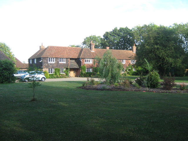
Bletchenden Cottage, Waterman Quarter. This long house used to be a row of cottages. Close to Bletchenden Manor Farm.
Footbridge over River Beult, near the Dairy. This bridge is on a footpath from Bletchenden, Waterman Quarter to Headcorn Railway Station. The Dairy is a large milk processing factory on the otherside of the river.


