Hereford Circular River Walk
![]()
![]() This splendid cathedral city is a fine place to explore for walkers. There's some lovely riverside trails, attractive parks and easy access to the local countryside from the city centre.
This splendid cathedral city is a fine place to explore for walkers. There's some lovely riverside trails, attractive parks and easy access to the local countryside from the city centre.
The city is also very close to the Malvern Hills and the Wye Valley AONB where there are numerous walking options through beautiful scenery.
This circular riverside walk from the city visits the cathedral and the castle site before following a riverside path into the surrounding countryside.
The walk starts at Hereford Cathedral. The historic site dates from the late 11th century and houses a particularly noteworthy chain library. The site also includes a nice cafe and some lovely cathedral gardens.
From the cathedral it is a short walk east to visit the site of Hereford Castle. The fortification was one of the earliest castles in England. It was probably destroyed when the Welsh sacked Hereford in 1055, but seems to have been replaced by the following decade.
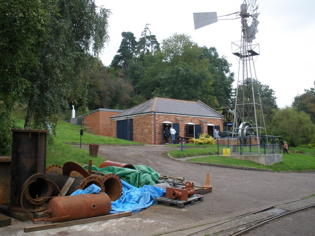
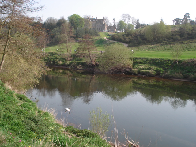
You then cross the river on the Victoria Footbridge and pick up the Wye Valley Walk. Follow the waymarked footpath west along the River Wye and it will take you to a playing field where you cross again. The trail continues west to Lower Breinton, a riverside area run by the National Trust. It's a picturesque area with an old church, pretty orchards and woodlands with bluebells during the spring months. From here you pick up a country lane and follow it east to the old Warham Court where there's an orchard and fields. You continue east past the Broomy Hills Waterworks Museum before returning to the city centre.
Hereford Ordnance Survey Map  - view and print off detailed OS map
Hereford Open Street Map  - view and print off detailed map
Hereford OS Map  - Mobile GPS OS Map with Location tracking
Hereford Open Street Map  - Mobile GPS Map with Location tracking
Walks near Hereford
- Mordiford Loop - This waymarked circular walk explores the countryside and woodland around the Herefordshire village of Mordiford
- Credenhill Woods - Follow the trails around Credenhill Park Wood on this easy walk in Herefordshire
- Queenswood Country Park - This splendid park is the only designated country park in Herefordshire
- Haugh Woods - These expansive woods near Hereford include mountain bike trails and a Butterfly Trail for walkers
- Fownhope - This Herefordshire based village is in a lovely spot near to the River Wye and some attractive bluebell woodland.
- Marcle Ridge Circular Walk - Climb to Marcle Ridge and enjoy splendid views towards the Malvern Hills on this circular walk in Herefordshire
- Golden Valley Herefordshire - This walk takes you through the beautiful Golden Valley in western Herefordshire
- Garway Hill - Climb across Garway Common to the summit of Garway Hill on this walk in in south-west Herefordshire
- Michaelchurch Escley - This little Herefordshire village is located on the eastern side of the Brecon Beacons, in the Black Mountains region
- Ledbury-Eastnor Castle-Malvern Hills - This walk from Ledbury takes you through the Eastnor Castle Estate before climbing into the hills to the east of the town
- Ross Round - This delightful circular walk takes you through the Herefordshire countryside around Ross-on-Wye.
You start on the River Wye, in the pretty market town of Ross-on-Wye, and follow the river north to the riverside settlement of Hole-in-the-Wall - Eastnor Deer Park - This walk follows a section of the Geopark Way long distance trail through the beautiful Eastnor Deer Park
- Malvern Common - This route takes you across the Peachfield and Malvern Commons in the Malvern Hills AONB
- Malvern Hills Circular Walk - This long route makes use of the Three Choirs Way and the old route of the Worcestershire Way to create a circular walk through the Malvern Hills Area of Outstanding Natural Beauty
- Malvern Hills - This walk takes you the full length of the Malvern Hills from End Hill in North Malvern to Chase End Hill at the southern end
- Herefordshire Beacon and British Camp - This walk climbs to Herefordshire Beacon in the Malvern Hills Area of Outstanding Natural Beauty
- Wye Valley Walk - This walk takes you through the beautiful Wye Valley in Gloucestershire, Herefordshire and Wales.
The walk begins on the mouth of the River Wye at Chepstow Castle in Monmouthshire and follows the River Wye north to Monmouth, passing the fascinating ruins of Tintern Abbey on the way - Daffodil Way - Explore the pretty countryside, orchards and woodland surrounding the village of Dymock on this circular walk in the Forest of Dean
- Bodenham Lake - This walk takes you along the peaceful Bodenham Lake in Herefordshire
- Mordiford Dragon Trail - This short walk celebrates Mordiford’s fascinating Dragon legend, taking you through some lovely local countryside and woodland on the way.
Pubs/Cafes
Back at the cathedral you could enjoy some refreshments in the on site coffee shop. If you prefer a pub lunch then The Barrels is a good choice. The inn dates from the 18th century and is formed partly from the old city wall. It includes a large, partially covered, walled and flag-stoned brewery yard, providing year-round 'alfresco' drinking. You can find them at 69 Owen's St with a postcode of HR1 2JQ for your sat navs.
Dog Walking
The river and country trails make for a fine dog walk. The Barrels pub mentioned above is also dog friendly.
Further Information and Other Local Ideas
For more walking ideas in the area see the Herefordshire Walks, the Malvern Hills Walks and the Wye Valley Walks pages.
Photos
Hereford, the River Wye and the cathedral. A place of worship has existed on the site of the present cathedral since the 8th century or earlier. Building commenced on the cathedral during the late 11th century. Substantial parts of the building date from both the Norman and the Gothic periods. It is designated as a Grade I listed building. It contains the largest library of chained book in the world, its most famous treasure being the Mappa Mundi, a medieval map of the world created around 1300 by Richard of Holdingham. The map is listed on the UNESCO Memory of the World Register.
Hereford Castle. The green area in which the memorial stands was once the site of Hereford Castle. By the end of the English Civil War the castle was in much need of repair. Instead however is was largely demolished and the motte, visible in the trees was much reduced. Toady this is an open public area.
Waterworks Museum, Broomy Hill. Extension added to house equipment from the Royal Ordnance Munitions Factory at Rotherwas.


