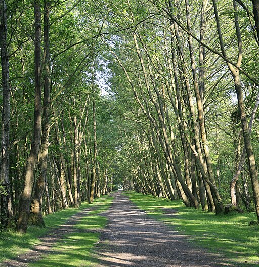
Holmsley Walk
![]()
![]() This walk takes you to the Holmsley Inclosure and Holmsley Bog in the New Forest. The area has a car park and a decent campsite which occupies part of what used to be Holmsley Airfield in WWII - one of 12 New Forest wartime airfields and Advanced Landing Grounds.
This walk takes you to the Holmsley Inclosure and Holmsley Bog in the New Forest. The area has a car park and a decent campsite which occupies part of what used to be Holmsley Airfield in WWII - one of 12 New Forest wartime airfields and Advanced Landing Grounds.
The walk starts from the Holmsley car park just south of Burley. From here you can head north towards the Holmsley Passage and Bog. Here you can pick up a trail along the old Southampton and Dorchester Railway Line. Follow it south east before heading south west to enter the Inclosure. You then follow the woodland footpaths around the site, visiting Lodge Hill, Hanging Shoot and Cardinal Hat before returning to the car park.
Postcode
BH24 4HY - Please note: Postcode may be approximate for some rural locationsHolmsley Ordnance Survey Map  - view and print off detailed OS map
Holmsley Open Street Map  - view and print off detailed map
Holmsley OS Map  - Mobile GPS OS Map with Location tracking
Holmsley Open Street Map  - Mobile GPS Map with Location tracking
Pubs/Cafes
At the campsite there's a fully equipped shop selling groceries and other items. At the south eastern end of the inclosure there's The Old Station Tea Rooms. It's set in the old Station House which was closed during the Beeching cuts in the 1960's. You can learn all about the history of the station which was originally opened in 1847. Now it's a delightful tea room where you can purchase a good range of meals and snacks. There's seating indoors or out if the weather is good. You can find them at Station Road with a postcode of BH24 4HY. They are dog friendly if you have your canine friend with you.
Further Information and Other Local Ideas
It's easy to extend the walk by heading a short distance east to explore Wilverley Plain and Inclosure. The plain is a popular place for a walk with a nice large grassy plain surrounded by more wooded trails.
You could also head into nearby Burley where there are some more good trails to try.
Just west of the site you could pick up the Bransgore Walk. This takes you across the Dur Hill Inclosure, the Kingston Great Common National Nature Reserve before climbing to the viewpoints at Vereley Hill and Picket Plain.
To the south is the market town of New Milton where there's a train station and some pleasant waterside trails around the Ballard Water Meadows.
For more walking ideas in the area see the New Forest Walks
Cycle Routes and Walking Routes Nearby
Photos
New Forest Airfields monument. This monument is on the edge of the old Second World War airfield at Holmsley.
View across Holmsley Bog towards Holmsley Passage. This is a view west across Holmsley Bog towards Holmsley Passage. The area in the foreground is labelled on the Ordnance Survey map as "Anthony's Bee Bottom". The name might sound odd, but I'd guess "Anthony" was a local name or person, "bee" refers to a bee garden where hives were put out during the blooming of the heather and "bottom" is a valley. The small house in the distance is at Holmsley Passage.
Disused road bridge. This is a former road bridge crossing the stream at the Holmsley end of the Clayhill Bottom mire complex. Beyond is the modern Station Road leading to Burley village across the heathland.
Pony grazing alongside the road to Holmsley Passage, New Forest Looking northeast from the road to Holmsley Passage. On the far side of the dip (Cot Bottom) is part of the Burley Golf Club's nine-hole course.
Pathway along the edge of the Holmsley Inclosure, New Forest. A variety of trees line this path which runs along the north-west edge of the Inclosure. The trees in the inclosure itself are an attractive mixture of conifers and broadleaved trees.


