New Milton Walks
![]()
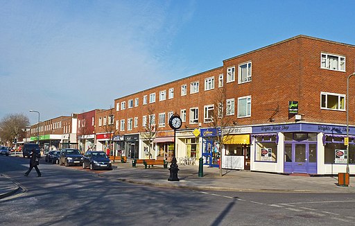
![]() This Hampshire market town is located close to the woodland trails of the New Forest and the coastal paths on the south coast.
This Hampshire market town is located close to the woodland trails of the New Forest and the coastal paths on the south coast.
To the south you can visit the coastal village of Barton on Sea where you can enjoy some lovely cliff top walks and views of the Isle of Wight. The Solent Way can be picked up to the east while the Bournemouth Coast Path can be accessed around Highcliffe Castle to the west.
Just to the north you can explore the New Forest on Wilverley Plain. The plain is a popular place for picnics in the warmer months.
This walk in the town visits the Ballard Water Meadows. The park is located just north of the town and includes pleasant footpaths around Ballard Lake, a pretty brook and some woodland. It's a nice peaceful place for a stroll and is just a short walk from the train station.
Postcode
BH25 5JX - Please note: Postcode may be approximate for some rural locationsNew Milton Ordnance Survey Map  - view and print off detailed OS map
New Milton Open Street Map  - view and print off detailed map
New Milton OS Map  - Mobile GPS OS Map with Location tracking
New Milton Open Street Map  - Mobile GPS Map with Location tracking
Walks near New Milton
- Milford Haven - The town of Milford Haven is in an ideal location for exploring the wonderful Pembrokeshire Coast.
This walk heads west along the coast path to visit the Dale Peninsula and Marloes Sands - Keyhaven Marshes - This coastal cycle or walk takes you from Lymington to Keyhaven through the beautiful Keyhaven and Pennington Marshes
- Hurst Castle Spit - Walk along this long shingle spit to one of Henry VIII's Device Forts on this lovely coastal walk in Hampshire
- Highcliffe Castle and Coast - Explore the grounds of this 19th century Gothic Revival house and enjoy a walk along the splendid Highcliffe coast and cliffs
- Christchurch Harbour - This fine circular walk takes you around the beautiful Christchurch Harbour in Dorset
- Solent Way - Follow the Solent Way along the beautiful south coast from Milford on Sea to Emsworth.
The route starts off at Milford on Sea and heads along the coastal marshes to Lymington with splendid views of the Isle of Wight - Wilverley Plain - This circular walk visits Wilverley Plain and the Wilverley Inclosure in the New Forest.
- Barton on Sea - This Hampshire based coastal village has some lovely trails along a cliff top path and a geologically significant beach to visit
- Burley New Forest - Enjoy a series of nice footpaths through the Old and New Burley Inclosures in the New Forest
- Blackwater Arboretum Trail - Explore the New Forest's Blackwater Arboretum on two super waymarked walking trails
- Ober Water - This nice, easy walk takes you around the pretty Ober Water in the New Forest
- Knightwood Oak - Visit the largest oak tree in the New Forest on this short, accessible walk
- Holmsley - This walk takes you to the Holmsley Inclosure and Holmsley Bog in the New Forest
- Bournemouth Coast Path - This super walk takes you along the beautiful Dorset and Hampshire coastline from Swanage to Lymington


