Kilnsey Crag
![]()
![]() This circular walk visits a striking limestone cliff in the village of Kilnsey in Wharfedale.
This circular walk visits a striking limestone cliff in the village of Kilnsey in Wharfedale.
Start the walk near Conistone Bridge where there is a parking area. From here you can follow a footpath north west towards Scar Lathe and Kilnsey Crag. The route then takes you south west down Mastiles Lane which is an old Roman Road. It can be followed all the way to Malham Tarn with full details on the Mastiles Lane Route. This route, however, turns east along the How Gill. This will lead you across Kilnsey Park back to Conistone Bridge. The walk circles around the Kilnsey Park which has a number of attractions to visit. These include a trout farm and nature trails with with wildlife such as red squirrels, angora goats, alpacas and butterflies to look out for on the way. There's also the Café by the Lake where you can relax outside and enjoy fine views over the Yorkshire Dales while enjoying a good home cooked dish from the menu.
The park and crag can be reached from nearby Grassington by following the Dales Way long distance walk from the town. See the Grassington to Conistone Walk for more details.
Kilnsey Crag Ordnance Survey Map  - view and print off detailed OS map
Kilnsey Crag Open Street Map  - view and print off detailed map
Kilnsey Crag OS Map  - Mobile GPS OS Map with Location tracking
Kilnsey Crag Open Street Map  - Mobile GPS Map with Location tracking
Further Information and Other Local Ideas
Just to the south of the crag you'll find the Grass Wood Nature Reserve. There's some nice woodland trails, bluebells in spring and lots of wildlife to see here. The reserve is notable as one of the largest areas of broadleaved woodland in the Dales.
Cycle Routes and Walking Routes Nearby
Photos
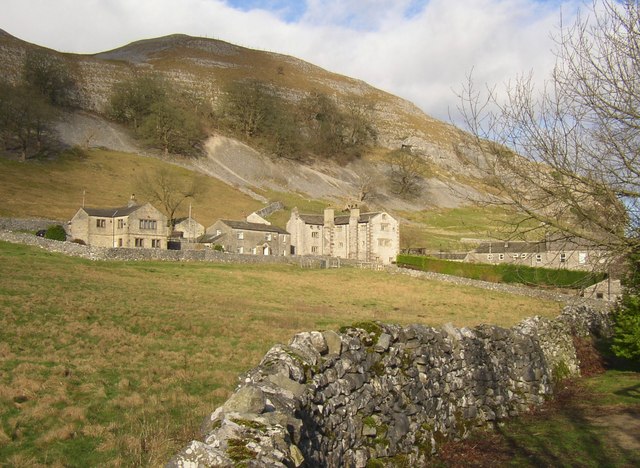
Old Hall and neighbouring houses, Mastiles Lane. Kilnsey Old Hall formed the main administrative centre for the management of wool for Fountains Abbey, which had extensive grazing land in the area. Some parts of the present Hall date back to this period, such as the gatehouse, most of which was probably built in the 14C. However most of the current hall was built in 1648 by Christopher Wade.


