Kirkstone Pass Walks
![]()
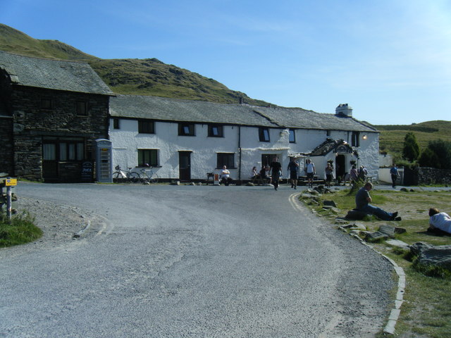
![]() The Kirkstone pass is located a few miles north of Ambleside at an altitude of 1,489 feet. This makes it the Lake District’s highest pass that is open to motor traffic. It is named after a large standing stone 500 metres from the inn on the road to Ullswater.
The Kirkstone pass is located a few miles north of Ambleside at an altitude of 1,489 feet. This makes it the Lake District’s highest pass that is open to motor traffic. It is named after a large standing stone 500 metres from the inn on the road to Ullswater.
This walk from the Kirkstone Pass Inn takes you up to the nearby Red Screes summit. It's only just over half a mile away but is a fairly steep climb.
Start the walk from the parking area at the remote inn. The pub is in an unusual elevated position making it the third-highest public house in England. From the inn you cross the road and pick up a trail heading north west up to the Kilnshaw Chimney and the red Screes summit. From here there are excellent views over the surrounding fells, down to Windemere Lake and across to the coast. There's also a pretty tarn at the summit.
After taking in the views you descend back to the pub on the same paths.
Postcode
LA22 9LQ - Please note: Postcode may be approximate for some rural locationsKirkstone Pass Ordnance Survey Map  - view and print off detailed OS map
Kirkstone Pass Open Street Map  - view and print off detailed map
Kirkstone Pass OS Map  - Mobile GPS OS Map with Location tracking
Kirkstone Pass Open Street Map  - Mobile GPS Map with Location tracking
Pubs/Cafes
The Kirkstone Pass Inn has a very cosy interior with an open log fire and oak beams. Here you can enjoy good home cooked food and some fine ales. If the weather is good you can sit outside and enjoy one of the finest views in the country with your meal.
The pub is a place of some interest dating back to the 15th century and notable as the highest inhabited building in Cumbria. It's also dog friendly if you have your canine friend with you.
Further Information and Other Local Ideas
To continue your walking from the Kirkstone Pass you could head north east up to Stony Cove Pike and then head south to the Troutbeck Tongue.
A few miles north of the inn you can visit the picturesque Brothers Water. Footpaths can be followed north from Red Screes to High Hartsop Dodd before coming to the small lake.
For more walking ideas in the area see the Lake District Walks page.


