Knaresborough River Walk
![]()
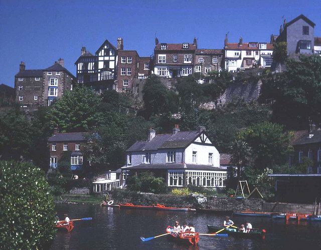
![]() Enjoy a lovely riverside walk along the River Nidd, from Knaresborough Castle to the nearby Conyngham Hall. The walk runs for just under two miles, starting from the ruins of the 12th century Knaresborough Castle. The 12th century castle sits in a fine location, next to the river, just south of the train station. For a fee you can explore the interior of the castle and visit the interesting museum which details the history of the castle. The grounds include pretty gardens, attractive lawns, a bowling green and a putting green are free to access. From the castle's elevated position there are also fine views over the surrounding area.
Enjoy a lovely riverside walk along the River Nidd, from Knaresborough Castle to the nearby Conyngham Hall. The walk runs for just under two miles, starting from the ruins of the 12th century Knaresborough Castle. The 12th century castle sits in a fine location, next to the river, just south of the train station. For a fee you can explore the interior of the castle and visit the interesting museum which details the history of the castle. The grounds include pretty gardens, attractive lawns, a bowling green and a putting green are free to access. From the castle's elevated position there are also fine views over the surrounding area.
From the castle head north and then west along the river until you come to High Bridge. Cross to the other side and you can follow footpaths through the woodland on the southern side of the water.
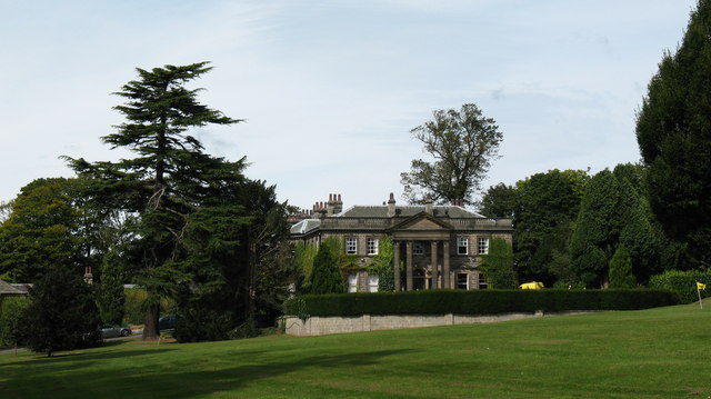
After the river bends round to the north you will come to a footbridge where you can cross to Conyngham Hall. There's nice trails to follow around the hall's open parkland, woodland and gardens.
After exploring the hall grounds the route then follows the northern side of the river back to the castle.
To extend the walk continue along the river into the wonderful Nidd Gorge. The gorge is a hugely popular walk and includes the impressive Nidd Viaduct and huge variety of wildlife to look out for.
You could also head south east along the river on the Knaresborough Round long distance trail. Heading in this direction will take you to Goldsborough where you could explore the beautiful gardens at the 16th century Goldsborough Hall.
Postcode
HG5 8AS - Please note: Postcode may be approximate for some rural locationsKnaresborough River Walk Ordnance Survey Map  - view and print off detailed OS map
Knaresborough River Walk Open Street Map  - view and print off detailed map
*New* - Walks and Cycle Routes Near Me Map - Waymarked Routes and Mountain Bike Trails>>
Knaresborough River Walk OS Map  - Mobile GPS OS Map with Location tracking
Knaresborough River Walk Open Street Map  - Mobile GPS Map with Location tracking
Further Information and Other Local Ideas
Just a couple of miles south of the town you'll find a bit of a hidden gem at Plumpton Rocks. In the park there's bluebell woods and some wonderful Millstone Grit rock formations overlooking a tranquil lake. The site is one of the most important landscape gardens in the North of England and well worth seeing if you are visiting the area.
Just to the south west of the town there's Rudding Park to see. The park includes a Grade I listed Regency-style country house, a spa and an 18-hole golf course in the 18th-century parkland. You can stay at the hotel and enjoy a popular spa day here. In this area you'll also enjoy walks along the Crimple Valley Beck to the impressive Crimple Railway Viaduct.
The historic Beningbrough Hall lies a few miles east of the town. The grounds of this Georgian mansion are a fine place for a stroll with views of the River Ouse and beautiful gardens to enjoy. On the opposite side of the river you can also see the village of Nun Monkton which sits at the confluence of the River Nidd and Ouse. The village has some interesting features including a village green, duck pond, pretty cottages, riverside trails and the impressive 17th century Nun Monkton Priory.
For more walking ideas in the area see the Nidderdale Walks page.


