Little Baddow Walks
![]()
![]() This pretty little village is located near to Chelmsford in Essex. It's very close to a number of fine riverside, country and woodland trails making a nice spot to start a walk.
This pretty little village is located near to Chelmsford in Essex. It's very close to a number of fine riverside, country and woodland trails making a nice spot to start a walk.
This circular walk from the village visits some of the local highlights including Little Baddow Hall, the Chelmer and Blackwater Navigation, Paper Mill Lock and the National Trust's Blake's Wood.
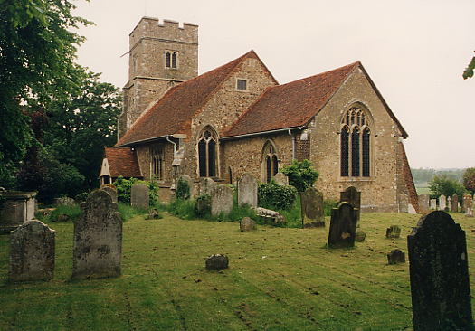
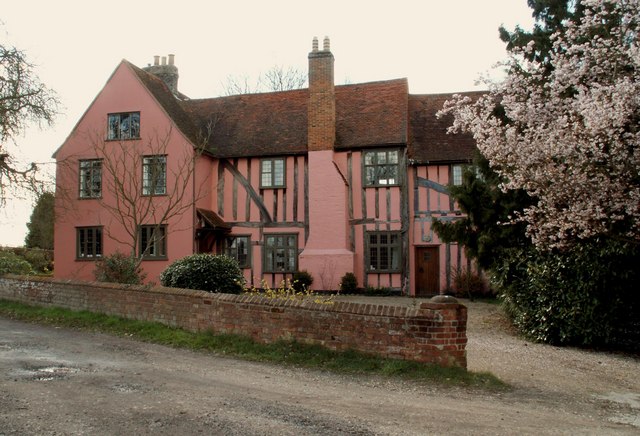
The walk starts in the village centre and heads west along Holybread Lane to Little Baddow Hall. The attractive timber-framed hall, dates back to the 14th-15th century, and stands directly opposite the parish church of St Mary the Virgin.
The route then heads north from the hall to meet up with the River Chelmer and follow a footpath east to Paper Mill Lock. It's a popular place for a walk with the picturesque lock and the adjacent Paper Mill tea rooms for refreshment.
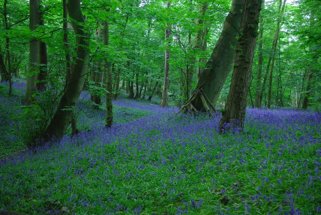
You continue east along the waterside path before turning south to Tofts, passing Bassett's Wood and Scrub Wood. The route then passes through the village to explore Blake's Wood to the south west. There's a number of trails here with oak, hornbeam and sweet chestnut trees and bluebells in the spring. You can also look out for a variety of woodland birds here. After exploring the woods the route then reutrns to the village.
Little Baddow Ordnance Survey Map  - view and print off detailed OS map
Little Baddow Open Street Map  - view and print off detailed map
Little Baddow OS Map  - Mobile GPS OS Map with Location tracking
Little Baddow Open Street Map  - Mobile GPS Map with Location tracking
Walks near Little Baddow
- Blake's Wood - Enjoy a series of nice woodland trails in this pretty wood in Chelmsford
- Paper Mill Lock - Enjoy an easy stroll along the Chelmer and Blackwater Navigation on this circular waterside walk from Paper Mill Lock
- Chelmer and Blackwater Navigation - Follow the Chelmer and Blackwater Navigation Canal from Chelmsford to Maldon on this easy, waterside walk in Essex
- Chelmsford - This walk in the Essex city of Chelmsford takes you along the River Can and River Chelmer to Sandford Mill
- Danbury Country Park - This country park in Essex has a number of good walking trails to enjoy
- Danbury Common - This large area of woodland and heath is managed by the National Trust
- Maldon - This pretty Essex town has a series of delightful waterside footpaths to try
- Terling - This pretty Essex village has many picturesque features including a ford on the River Ter, an old windmill, a cricket pitch and cottages around Church Green.
Pubs/Cafes
Back in the village you could enjoy some post walk refreshment at The General Arms. They serve good quality food which you can enjoy in the lovely large garden area on summer days. You can find them at the Ridge with postcode CM3 4SX for your sat navs.
Dog Walking
The countryside and woods surrounded the village are ideal for a dog walk. The General Arms mentioned above is also dog friendly.
Further Information and Other Local Ideas
To the south and the south east of the village there are lots more good trails to explore through Lingwood Common and Woodham Walter Common.
Danbury Country Park and Danbury Common are located a few miles to the south. They are both good options for cycling and walking in the local area.
To the north is the neighbouring village of Terling. Here you'll find a ford on the River Ter, an old windmill, a cricket pitch and lots of picturesque cottages around Church Green.
For more walking ideas in the area see the Essex Walks page.
Photos
Little Baddow Village Green. The tree in the background was planted to commemorate the 50th anniversary of the end of the second world war.
This is one of the weirs at Paper Mill Lock on the Chelmer navigation. There used to be two mills on the island to the left between the river and the navigable stream. One for flour and one for mica used in the paper making industry.
Footbridge over stream in Blakes Wood. This footbridge crosses the stream which runs through Blakes Wood. Trees have been growing in Blakes Wood for 10.000 years, since the last ice age. The site has been managed by man for many centuries using the technique of coppicing - cutting trees to the ground and then allowing them to regrow in following years. Traditionally this process provided a regular supply of timber for fences and firewood, but is now recognised as also being beneficial for wildlife by encouraging woodland flowers and providing an ideal habitat for insects and birds.


