Llanbedr Walks
![]()
![]() The Gwynedd village of Llanbedr is in a great location on the edge of the Snowdonia National Park and close to some beautiful coast, riverside trails and a scenic river estuary.
The Gwynedd village of Llanbedr is in a great location on the edge of the Snowdonia National Park and close to some beautiful coast, riverside trails and a scenic river estuary.
This walk takes you along a section of the Wales Coast path to neighbouring Llandanwg.
The walk starts at Llanbedr train station. From here head north west and you can pick up a section of the Wales coast path along the River Artro. This will take you past the Neolithic standing stones towards Sarn Hir where you cross the river. Continue north west and the path will take you past Pensarn with great views over the Artro Estuary to the Rhinog Mountains.
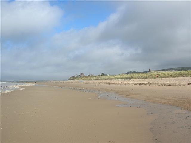
The route then continues to the coast at Llandanwg. Here you can explore the Twyni Llandanwg Sand Dunes and the lovely beach. There's also the National Trust's Y Maes located behind the dunes.
Postcode
LL45 2LD - Please note: Postcode may be approximate for some rural locationsLlanbedr Ordnance Survey Map  - view and print off detailed OS map
Llanbedr Open Street Map  - view and print off detailed map
*New* - Walks and Cycle Routes Near Me Map - Waymarked Routes and Mountain Bike Trails>>
Llanbedr OS Map  - Mobile GPS OS Map with Location tracking
Llanbedr Open Street Map  - Mobile GPS Map with Location tracking
Walks near Llanbedr
- Rhinog Fawr - Visit the Rhinogs range of mountains in the Snowdonia National Park and climb Rhinog Fawr on this challenging walk
- Llyn Cwm Bychan - Enjoy a short walk or cycle along this pretty lake in the Rhinogs
- Taith Ardudwy Way - This walk takes you through the Snowdonia National Park from Barmouth, on the Mawddach Estuary, to Llandecwyn
- Panorama Walk Barmouth - A classic circular walk around Barmouth climbing above the town for magnificent views over the Mawddach estuary and the Snowdonia National Park
- Harlech - This town on the edge of the Snowdonia National Park has some lovely coastal footpaths to try
- Dinas Oleu - This walk climbs to a hill fort and lovely viewpoint above the town of Barmouth
- Dyffryn Ardudwy - This North Wales village sits in a lovely position on the edge of the Snowdonia National Park and only a short walk from the coast
- Nantcol Waterfalls Walk - This circular walk explores the beautiful Rhaeadr Nantcol Waterfalls in Snowdonia in North Wales.
- Llyn Cwm Bychan Roman Steps and Pistyll Gwyn Walk - This walk takes you from Llyn Cwm Bychan to the Pistyll Gwyn Waterfalls via the Roman Steps.
Pubs/Cafes
Head to the Victoria Inn for some post walk refreshments. The pub is in a nice location on the bank of the River Artro in the village. They serve good home cooked food and have a nice garden area to the rear. You can find them at postcode LL45 2LD for your sat navs.
Dog Walking
The river and coast paths make for a fine dog walk. The Victoria Inn mentioned above is also dog friendly.
Further Information and Other Local Ideas
Head east into Snowdonia and you can enjoy a more challenging walk to Rhinog Fawr. Also just to the east is something of a hidden gem at the wonderful Nantcol Waterfalls. The area includes pleasant trails along the River Cwmnantcol with a series of rushing waterfalls to see along the way. There's also a circular walk around a small reservoir, just west of the falls.
The Harlech Walk runs past the village. This visits the nearby Morfa Dyffryn Nature Reserve. The beautiful reserve includes huge sand dunes, seashore, saltmarsh and grassland with a wide variety of wildlife to look out for.
Just to the south there's the village of Dyffryn Ardudwy where there's a train station for public transport access. There's also the fascinating Dyffryn Ardudwy Burial chamber to explore in the village. The ancient site includes a hut circle and a number of dolmen dating back over 6000 thousand years.
For more walking ideas in the area see the Snowdonia Walks page.


