Nantcol Waterfalls Walk
![]()
![]() This circular walk explores the beautiful Rhaeadr Nantcol Waterfalls in Snowdonia in North Wales.
This circular walk explores the beautiful Rhaeadr Nantcol Waterfalls in Snowdonia in North Wales.
The falls are located along the River Cwmnantcol in the county of Gwynedd, near the settlements of Llanbedr and Harlech on the coast.
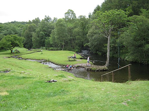
You can start your walk from the car park at the campsite. From here you pick up the riverside walk heading south to the picturesque falls. The route then loops round through peaceful woodlands before returning to the campsite. You then have the option of extending the walk by heading west to visit a small reservoir where you will find another circular path.
There's a pleasant picnic area by the campsite where you can enjoy a rest and some refreshment after your exercise.
Postcode
LL45 2PL - Please note: Postcode may be approximate for some rural locationsNantcol Waterfalls Walk Ordnance Survey Map  - view and print off detailed OS map
Nantcol Waterfalls Walk Open Street Map  - view and print off detailed map
*New* - Walks and Cycle Routes Near Me Map - Waymarked Routes and Mountain Bike Trails>>
Nantcol Waterfalls Walk OS Map  - Mobile GPS OS Map with Location tracking
Nantcol Waterfalls Walk Open Street Map  - Mobile GPS Map with Location tracking
Pubs/Cafes
Just to the west is Llanbedr Head where you could head to the Victoria Inn for some post walk refreshments. The pub is in a nice location on the bank of the River Artro in the village. They serve good home cooked food and have a nice garden area to the rear. You can find them at postcode LL45 2LD for your sat navs.
Dog Walking
The river and woodland trails make for a fine dog walk. The inn mentioned above is also dog friendly.
Further Information and Other Local Ideas
Head west to the coast and you could explore the wonderful Morfa Dyffryn Nature Reserve. The beautiful reserve includes huge sand dunes, seashore, saltmarsh and grassland with a wide variety of wildlife to look out for. Near here there's also the small village of Dyffryn Ardudwy where there's a train station for public transport access. There's also the fascinating Dyffryn Ardudwy Burial chamber to explore in the village. The ancient site includes a hut circle and a number of dolmen dating back over 6000 thousand years.


