Llandegfedd Reservoir Circular Walk with OS Map
![]()
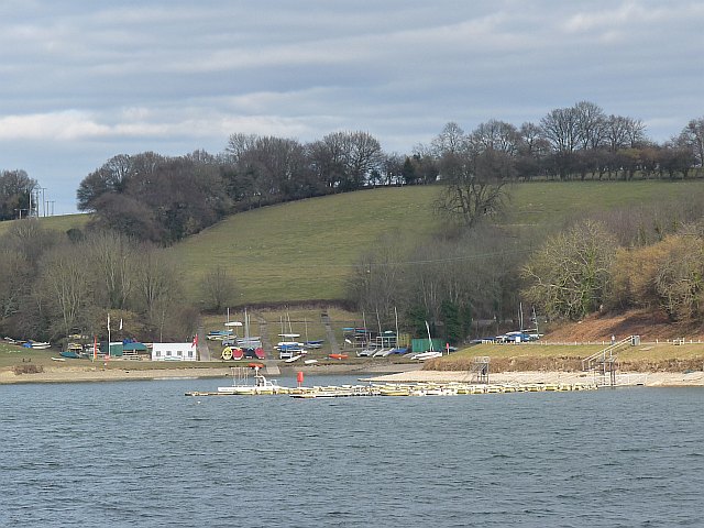
![]() Enjoy a long circular walk around this beautiful reservoir near Cwmbran and Newport. The complete trail runs for about 10km (6.2) miles through the countryside and woodland surrounding the reservoir. Please note that some parts of the trail are closed between October 1st to March 1st.
Enjoy a long circular walk around this beautiful reservoir near Cwmbran and Newport. The complete trail runs for about 10km (6.2) miles through the countryside and woodland surrounding the reservoir. Please note that some parts of the trail are closed between October 1st to March 1st.
The walk starts from the visitor centre car park at the southern end of the water. It then heads along the western side of the water towards Glascoed, before returning on the eastern side. There's some moderate climbing involved with the walk reaching a peak height of over 450ft. From the high points there are great views backs down to the reservoir. Along the way there are also a number of pleasant woodland trails, pretty streams and hay meadows where you can see wildflowers in the summer months.
The reservoir is a great place for bird watching with a number of hides dotted along the route. Look out for birds including wigeon, teal, pochard, goldeneye and ruddy duck as you make your way around the site.
Llandegfedd Reservoir is located just to the east of Pontypool. You can continue your walking here by picking up the Monmouthshire and Brecon Canal.
Postcode
NP4 0SS - Please note: Postcode may be approximate for some rural locationsLlandegfedd Reservoir Ordnance Survey Map  - view and print off detailed OS map
Llandegfedd Reservoir Open Street Map  - view and print off detailed map
*New* - Walks and Cycle Routes Near Me Map - Waymarked Routes and Mountain Bike Trails>>
Llandegfedd Reservoir OS Map  - Mobile GPS OS Map with Location tracking
Llandegfedd Reservoir Open Street Map  - Mobile GPS Map with Location tracking
Explore the Area with Google Street View 
Pubs/Cafes
The visitor centre at the lake includes a great cafe with fine views over the water.
Dog Walking
The reservoir is a popular place for a dog walk but please keep them on leads as there are nesting birds and livestock at the site.
Further Information and Other Local Ideas
Head into Pontypool and you explore the worthy Pontypool Park. The extensive park includes ponds, woodland, Italian gardens, a stone circle, streams and a ski slope.
On the north western edge of Cwmbran you'll find Blaen Bran Reservoir. There's some nice community woodland here with a waterfall and excellent views down to the two reservoirs from the surrounding hills.
Just to the east there's the town of Usk where you can enjoy riverside walks and visit the Cefn Ila Woodlands.


