Llanthony Priory Circular Walk
![]()
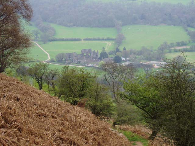
![]() This walk visits the historic Llanthony Priory in the Vale of Ewyas, Brecon Beacons. The former Augustinian priory dates back to 1100 and is a Grade I listed building. The picturesque ruins are now under the care of Cadw and entrance is free to the public.
This walk visits the historic Llanthony Priory in the Vale of Ewyas, Brecon Beacons. The former Augustinian priory dates back to 1100 and is a Grade I listed building. The picturesque ruins are now under the care of Cadw and entrance is free to the public.
The Brecon Beacons Way long distance trail runs past the abbey so this route uses part of the waymarked path to create a circular walk around the abbey. You can start from the car park next to the priory and then follow footpaths east to pick up the long distance trail. Follow the trail south east and the path will join with the Offa's Dyke Path. The National Trail runs just to the east of the priory and is a great way of exploring this area on the English-Welsh border. This route heads west along public footpaths to Maes-y-Beran before turning north west to return to the car park.
If you head south along Offa's Dyke you could enjoy a climb to the viewpoint on Hatterrall Hill.
Postcode
NP7 7NN - Please note: Postcode may be approximate for some rural locationsLlanthony Priory Circular Walk Ordnance Survey Map  - view and print off detailed OS map
Llanthony Priory Circular Walk Open Street Map  - view and print off detailed map
Llanthony Priory Circular Walk OS Map  - Mobile GPS OS Map with Location tracking
Llanthony Priory Circular Walk Open Street Map  - Mobile GPS Map with Location tracking
Pubs/Cafes
Head to the Llanthony Priory Hotel for some post walk refreshments. The site includes a small country inn, often known as the "Abbey Hotel", which sits within the original 12th century Augustinian priory. They have a good menu and a cosy interior with a vaulted ceiling and open log fire. You can find it at a postcode of NP7 7NN for your sat navs.
Further Information and Other Local Ideas
To extend your walking in the area head west from the priory into the Black Mountains. Here you can visit the nearby Castell Dinas Bran and climb Waun Fach for great views over the area.
Just to the west of the priory you'll find miles of woodland trails in the Mynydd Du Forest and some nice waterside footpaths around the lovely Grwyne Fawr Reservoir.
The Gospel Pass cycle route runs along the highest road pass in Wales from Hay on Wye to the priory. The elevated road is a splendid way to view the scenery of the Black Mountains.
For more walking ideas in the area see the Brecon Beacons Walk page.


