Llyn Geirionydd
![]()
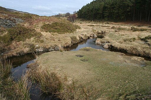
![]() An easy circular walk around the delightful Llyn Geirionydd in the Gwydyr Forest area of the Snowdonia National Park. It's a very peaceful area with great views of the Carneddau mountains and the woodland surrounding the lake.
An easy circular walk around the delightful Llyn Geirionydd in the Gwydyr Forest area of the Snowdonia National Park. It's a very peaceful area with great views of the Carneddau mountains and the woodland surrounding the lake.
You can start the walk from the car park at the south eastern end of the lake. There's a picnic area and toilets here too. Follow the little country lane along the eastern side of the water before crossing the River Geirionydd at the northern end. A public footpath then runs along the western side of the lake, just below Mynydd Deulyn.
If you head west you can enjoy two more lovely reservoir walks at Llyn Cowlyd and Llyn Crafnant. Llyn Cowlyd is the deepest lake in North Wales and has more nice waterside trails. Llyn Crafnant has a fine circular trail with a lakeside cafe which also hires rowing boats.
You could also follow the trails along the River Geirionydd at the northern end of the water or pick up the woodland trails in the surrounding forests.
The lake is located near to the village of Trefriw where you can enjoy a little walk along the delightful Fairy Falls.
Postcode
LL27 0YX - Please note: Postcode may be approximate for some rural locationsLlyn Geirionydd Ordnance Survey Map  - view and print off detailed OS map
Llyn Geirionydd Open Street Map  - view and print off detailed map
*New* - Walks and Cycle Routes Near Me Map - Waymarked Routes and Mountain Bike Trails>>
Llyn Geirionydd OS Map  - Mobile GPS OS Map with Location tracking
Llyn Geirionydd Open Street Map  - Mobile GPS Map with Location tracking
Pubs/Cafes
About half a mile to the west of the lake you'll find Llyn Crafnant which has a decent Lakeside Cafe. You can reach it by following a public footpath at the southern end of the lake. The cafe does a good range of meals and is in a lovely spot with views across the lake.
Further Information and Other Local Ideas
A few miles to the east you will find the noteworthy market town of Llanrwst. Here you can try the circular Llanrwst Walk which visits some of the towns highlights. These include the splendid Gwydir Estate which contains a historic castle, an ancient chapel, the Grey Mare's Tail Waterfall and an expansive forest.
For some interesting local history try the Dolgarrog Pipeline Walk. This explores the area around the little village, visiting the impressive pipeline structure and the Coedty reservoir. Near here there's also the beautiful Llyn Eigiau where the reservoir dam was breached leading to the Dolgarrog Dam disaster of 1925.
Just east of Dolgarrog there's the climb to Cadair Ifan Goch, a National Trust owned area. From the summit of the hills there are excellent views over the River Conwy Valley to the Carneddau mountains.
For more walking ideas in the area see the Snowdonia Walks page.


