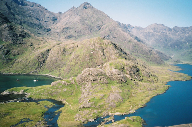
Loch Coruisk
![]()
![]() This circular hike takes you around the stunning Loch Coruisk in the Cullin Hills on the Isle of Skye.
This circular hike takes you around the stunning Loch Coruisk in the Cullin Hills on the Isle of Skye.
It's a remote spot with some fairly rugged paths surrounding the isolated loch. Legend has it that the fresh water loch is the home of a kelpie or water horse, a shape-shifting creature that can assume human form.
The site is located south of Sligachan and north of Elgol. If you head north west of the loch you could visit another of the area's highlights at the delightful Fairy Pools. The Camasunary Walk can also be found to the east.
Loch Coruisk Ordnance Survey Map  - view and print off detailed OS map
Loch Coruisk Open Street Map  - view and print off detailed map
*New* - Walks and Cycle Routes Near Me Map - Waymarked Routes and Mountain Bike Trails>>
Loch Coruisk OS Map  - Mobile GPS OS Map with Location tracking
Loch Coruisk Open Street Map  - Mobile GPS Map with Location tracking
Further Information and Other Local Ideas
Head north and you can visit the Island's capital at Portree. Here you can pick up the circular Portree Scorrybreac Walk and enjoy views of the picturesque harbour, the colourful buildings of Portree town and out to the Island of Raasay.
To the north west there's the lovely Talisker Bay Beach. Here you will find a lovely, quiet beach with some impressive sea stacks and views to a waterfall.
For more walking ideas in the area see the Isle of Skye Walks page.
Cycle Routes and Walking Routes Nearby
Photos
Surrounded by the Cuillin Hills on the Isle of Skye, Loch Coruisk. is one of my favourite locations in the whole of the British Isles. There are no roads here. You get there by foot or by boat.


