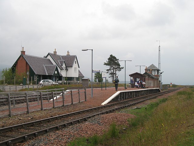
Corrour Station and Loch Ossian Walk
![]()
![]() This walk visits the beautiful Loch Ossian from the remote Corrour Station on Rannoch Moor.
This walk visits the beautiful Loch Ossian from the remote Corrour Station on Rannoch Moor.
The station is situated on the Crianlarich-Fort William/Mallaig branch of the West Highland Line. It is notable as the highest mainline railway station in the United Kingdom. The station is served by regular Abellio ScotRail passenger trains between Glasgow Queen Street and Fort William/Mallaig.
The walk starts from the train station where you can pick up a trail heading north east past the smaller Loch Coir' a'Bhric Beag. The trail then continues along the southern side of the loch before finishing at the jetty and boating house at the northern end. The area is popular with red deer so keep your eyes peeled for these beautiful creatures as you make your way through the woods and moor.
To continue your lochside walking in the area head west to visit Loch Treig.
Postcode
PH30 4AA - Please note: Postcode may be approximate for some rural locationsLoch Ossian Ordnance Survey Map  - view and print off detailed OS map
Loch Ossian Open Street Map  - view and print off detailed map
Loch Ossian OS Map  - Mobile GPS OS Map with Location tracking
Loch Ossian Open Street Map  - Mobile GPS Map with Location tracking
Further Information and Other Local Ideas
To continue your walking in the area head south west to visit the splendid Buachaille Etive Mor. Glen Etive, the Glencoe Lochan Trail, the Three Sisters Glencoe Waterfall Walk and the Pap of Glencoe are also not too far to the west.
You could visit the second highest waterfall in Scotland on the Steall Falls Walk. It's a spectacular sight and another of the highlights of the area.
For more walking ideas in the area see the Scottish Highlands Walks page.
Cycle Routes and Walking Routes Nearby
Photos
Corrour Station. A short platform station on Rannoch Moor, often busy with folk heading off or back from nearby hills or lochs. The station is ideally placed for many cross country routes, and the railway solves the getting back from the other end problem. We were leaving, heading for Spean Bridge. Once I would travel here all the way by train, but this is not really possible to do at short notice anymore because of the insane fare structure in use at this time.


