Loch Rannoch Forest Walks
![]()
![]() This walk takes you along the lovely Loch Rannoch in Pitlochry in Perth and Kinross. The freshwater loch is part of the Loch Rannoch and Glen Lyon National Scenic Area.
This walk takes you along the lovely Loch Rannoch in Pitlochry in Perth and Kinross. The freshwater loch is part of the Loch Rannoch and Glen Lyon National Scenic Area.
The walk starts at the eastern end of the loch in the village of Kinloch Rannoch where parking is available. The route then follows a country lane along the southern end side of the water, passing the war memorial viewpoint before entering the Rannoch Forest. There's miles of forestry trails here, taking you along the Carie Burn to Carie. The area of forestry is known as the Black Wood of Rannoch, a fragment of the old Caledonian Forest. It is designated as a Special Area of Conservation and includes a number of rare plants. You can look out for wildlife including Scottish crossbill and capercaillie in this interesting area.
Head north along the River Ericht and you could visit the nearby Loch Ericht to extend your walking in the area. There's another nice waterside path here with excellent views towards Ben Alder.
Postcode
PH16 5PF - Please note: Postcode may be approximate for some rural locationsLoch Rannoch Ordnance Survey Map  - view and print off detailed OS map
Loch Rannoch Open Street Map  - view and print off detailed map
Loch Rannoch OS Map  - Mobile GPS OS Map with Location tracking
Loch Rannoch Open Street Map  - Mobile GPS Map with Location tracking
Pubs/Cafes
The Riverbank Cafe in Kinloch Rannoch village is a nice place for some post walk refreshment. The friendly cafe serves a good range of meals and delicious cakes. There are nice views over to the adjacent field where you can sometimes see deer. You can find them on the Square at postcode PH16 5PF for your sat navs.
Dog Walking
The loch and the forest to the south are ideal for dog walking. The Riverbank Cafe mentioned above is also very dog friendly.
Further Information and Other Local Ideas
To the north west there's more splendid lochside walking to enjoy at Loch Arkaig, Loch Oich, Loch Garry and Loch Lochy in the Highlands. You can also pick up the epic Great Glen Way and the Caledonian Canal in this area.
Just a few miles to the east there's another major local highlight at the stunning Falls of Bruar. The lovely wooded gorge includes beautiful waterfalls, several deep black pools, stone bridges, viewpoints and picnic spots. There's also the House of Bruar department store where there's an excellent food hall for refreshments.
To the south you can explore the beautiful and peaceful Glen Lyon. The route takes you along the River Lyon to Loch Lyon with a visit to the lovely post office cafe in Bridge of Balgie at the start.
For more walking ideas in the area see the Scottish Highlands Walks page.
Cycle Routes and Walking Routes Nearby
Photos
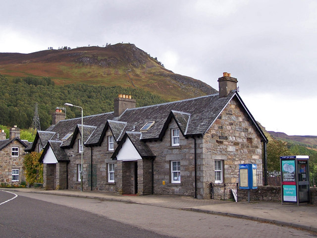
Cottages in Kinloch Rannoch. These cottages are in Allt Mor Place in the centre of the village. The crag beyond is Craig Varr.


