Lulworth Castle
![]()
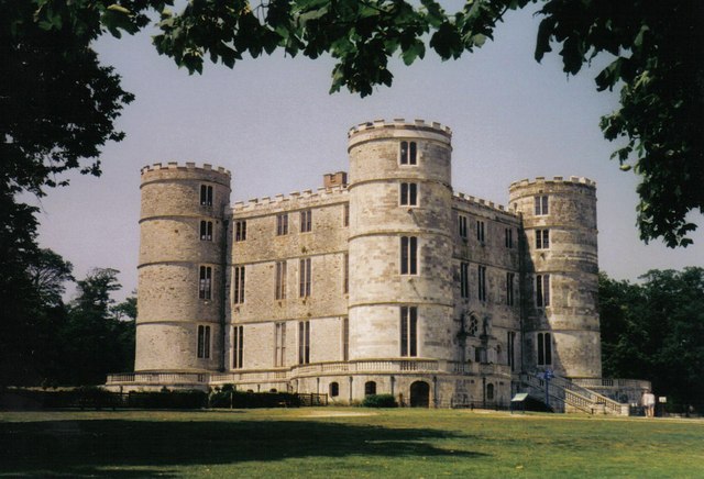
![]() Explore the beautiful grounds of this 17th Century castle on this circular walk in Dorset. You will pass the exquisite 18th century Chapel of St Mary's, the fascinating Lulworth Castle House and the recently restored Lulworth Castle.
Explore the beautiful grounds of this 17th Century castle on this circular walk in Dorset. You will pass the exquisite 18th century Chapel of St Mary's, the fascinating Lulworth Castle House and the recently restored Lulworth Castle.
The Purbeck Way passes the castle so you have the option of visiting by public transport. You could catch the train to nearby Wool and then follow the Hardy Way and the Purbeck Way to the castle. To extend your walking in the area head to the coast to visit the wonderful Lulworth Cove and Durdle Door. For a longer walk you could try the Lulworth Cove to Osmington Mills Coastal Walk.
Postcode
BH20 5QS - Please note: Postcode may be approximate for some rural locationsPlease click here for more information
Lulworth Castle Ordnance Survey Map  - view and print off detailed OS map
Lulworth Castle Open Street Map  - view and print off detailed map
Lulworth Castle OS Map  - Mobile GPS OS Map with Location tracking
Lulworth Castle Open Street Map  - Mobile GPS Map with Location tracking
Explore the Area with Google Street View 
Pubs/Cafes
The Weld Arms is located at the foot of the castle gates in East Lulworth. The thatched 17th century pub serves good quality food and includes a lovely garden area for warmer days.
Dog Walking
The parkland on the castle estate is great for dog walking. You are asked to keep them on leads because of the livestock. Only assistance dogs are allowed into Lulworth Castle, the Chapel and Church.
The Weld Arms mentioned above is also dog friendly.
Further Information and Other Local Ideas
Just to the south east you can pick up the Kimmeridge Bay to Chapmans Pool Walk and explore a wonderful marine wildlife reserve with lots of interesting creatures to look out for in the rock pools and ocean.
Just to the north west there's the Winfrith Newburgh Heath and Tadnoll Nature Reserves. The reserves include miles of peaceful heathland trails with lots of wildlife and a splendid viewpoint.
Cycle Routes and Walking Routes Nearby
Photos
Lulworth Castle. Built in 1608, destroyed by fire in 1929 and restored in the 1990s, this was not a castle that was ever intended for the purposes of defence.
East Lulworth: church built to look like a house. The Catholic church of St. Mary, in the grounds of 474252, was built by Thomas Weld in 1795. He had received permission from King George III to build the first Catholic church since the Reformation - on condition that it were built to resemble a garden temple.
Wareham Gate Lodge. This building had lain derelict for 50 years before being re-erected in 1808 in its present position. It does not provide access to the castle itself, just to this wooded part of the grounds.


