Lyme Regis to Charmouth Walk
![]()
![]() Follow the coastal path from Lyme Regis to Charmouth on this popular walk in West Dorset. This circular walk follows the South West Coast Path from the centre of Lyme Regis to the pretty village of Charmouth before returning along the beach.
Follow the coastal path from Lyme Regis to Charmouth on this popular walk in West Dorset. This circular walk follows the South West Coast Path from the centre of Lyme Regis to the pretty village of Charmouth before returning along the beach.
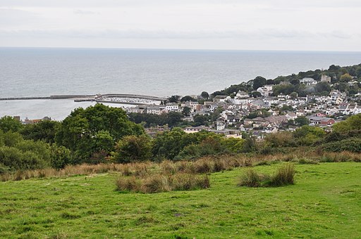
You start the walk in Lyme Regis and climb towards the golf course above Timber Hill. The path crosses the golf course and the woodland on Fern Hill before descending to Charmouth. After exploring the village you then pass along the beach to return to Lyme Regis. You'll pass the striking cliffs at Black Ven and the Spittles which are a well known fossil hunting spot. Please note it's wise to check the tide times before walking back along the beach. The tide should be going out before you start the return leg. If it is coming in then return on the same path above the towns.
If you would like to extend your walk you could try the circular Charmouth Walk. It visits Stonebarrow Hill and includes some lovely cliff top scenery, beautiful beaches and a range of interesting flora and fauna. Continue east and you can visit the splendid Golden Cap Estate.
Also of interest is the Uplyme to Lyme Regis Walk which takes you along the River Lim from East Devon to Dorset.
Lyme Regis to Charmouth Ordnance Survey Map  - view and print off detailed OS map
Lyme Regis to Charmouth Open Street Map  - view and print off detailed map
*New* - Walks and Cycle Routes Near Me Map - Waymarked Routes and Mountain Bike Trails>>
Lyme Regis to Charmouth OS Map  - Mobile GPS OS Map with Location tracking
Lyme Regis to Charmouth Open Street Map  - Mobile GPS Map with Location tracking
Pubs/Cafes
At the end of the route there's the Beach Cafe at Charmouth. There's a good range of meals, snacks and locally made cakes.
Next to the cafe there's also the
Charmouth Heritage Coast Centre where you can see a wonderful fossil collection including an ichthyosaur that starred in the BBC documentary ‘Attenborough and the Sea Dragon’. There's also guided fossil hunting walks to try here.
Further Information and Other Local Ideas
Head a few miles inland and you could try the National Trust's Lamberts Castle to Coneys Castle Walk. The walk visits historic old hill forts where you can enjoy some stunning views over the countryside of the Marshwood Vale.
Just to the east there's the climb to the lovely viewpoint at Colmers Hill from the picturesque village of Symondsbury. The historic village includes an ancient church and a noteworthy 15th century, thatched pub.
Cycle Routes and Walking Routes Nearby
Photos
The Spittles. View north-east from Lyme Regis sea front to The Spittles at low tide. This area is very unstable and prone to landslips.


