Marsden to Slaithwaite Canal Walk
![]()
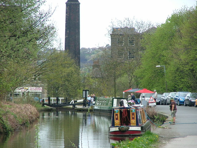
![]() This easy walk takes you along a lovely section of the Huddersfield Narrow Canal from Marsden to Slaithwaite. The route runs for a distance of about 3 miles, running along the flat towpath so perfect for an afternoon stroll. On the way you'll pass a number of pretty locks, canal barges, historic mills, weirs and canalside pubs where you can stop for a bite to eat.
This easy walk takes you along a lovely section of the Huddersfield Narrow Canal from Marsden to Slaithwaite. The route runs for a distance of about 3 miles, running along the flat towpath so perfect for an afternoon stroll. On the way you'll pass a number of pretty locks, canal barges, historic mills, weirs and canalside pubs where you can stop for a bite to eat.
The walk starts in Marsden train station which is located right next to the canal. The route then follows the towpath east, passing the old mills and reservoirs at Park Gate. You continue past Lingards Wood and Waring Bridge, before coming into Slaithwaite. Here you will pass a series of old mills and weirs, before finishing near the town centre and train station. You can extend the walk by continuing east into Huddersfield itself.
Marsden to Slaithwaite Canal Walk Ordnance Survey Map  - view and print off detailed OS map
Marsden to Slaithwaite Canal Walk Open Street Map  - view and print off detailed map
*New* - Walks and Cycle Routes Near Me Map - Waymarked Routes and Mountain Bike Trails>>
Marsden to Slaithwaite Canal Walk OS Map  - Mobile GPS OS Map with Location tracking
Marsden to Slaithwaite Canal Walk Open Street Map  - Mobile GPS Map with Location tracking
Pubs/Cafes
At the end of the walk there's lots of good options for refreshments in Slaithwaite. We recommend The Little Bridge which has a delightful outdoor terrace overlooking the canal. There's also a great menu and a cosy fire indoors on colder days. You can find the pub next to the canal on Britannia Road with a postcode of HD7 5HF for your sat navs.
In Marsden there's the noteworthy Riverhead Brewery Tap to visit. It does good food and is an excellent place for real ale connsiseurs. On the ground floor in the bar, there are 10 real ale hand pumps several of which are permanently dedicated to the popular Riverhead beers brewed on-site. The famous Riverhead micro-brewery is housed downstairs in the cellar. Here they brew a wide range of beers all with a local connection. Hot and cold food is served regularly with all dishes freshly prepared on site. You can find the pub in the picturesque village, next to the River Colne, on Peel Street with a postcode of HD7 6BR for your sat navs.
Further Information and Other Local Ideas
Near the end of the walk in Slaithwaite you could extend your exercise by heading north west to visit Scammonden Reservoir and Deanhead Reservoir where there's some pleasant waterside paths.
Cycle Routes and Walking Routes Nearby
Photos
Huddersfield Narrow Canal, Marsden Looking northeast towards lock 39D from where Marsden Lane goes over the canal.


