Martley Circular Walk
![]()
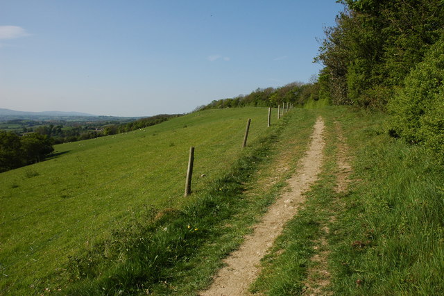
![]() This lovely waymarked walk explores the Teme Valley around the Worcestershire village of Martley. There's beautiful countryside, traditional orchards, riverside paths and woodland trails to enjoy on the way. The route runs for about 6 miles on fairly flat paths with some small climbs.
This lovely waymarked walk explores the Teme Valley around the Worcestershire village of Martley. There's beautiful countryside, traditional orchards, riverside paths and woodland trails to enjoy on the way. The route runs for about 6 miles on fairly flat paths with some small climbs.
Start the walk in the centre of the village and follow the footpaths north past the The Chantry School towards the orchards around Alden's Farm and Prickley Green Farm. The path then turns west towards Rodge Hill Farm where you pick up a section of the Worcestershire Way long distance trail. You then climb south to Rodge Hill and Pudford Hill where there are splendid views over the surrounding countryside. From this high point of the walk you descend to Hambridge Farm where you pick up a riverside path along the River Teme, passing the woodland on Kingswood Common before turning east to return to the village. Back in Martley you can enjoy refreshments at the local pub and pay a visit to the interesting Norman Church of St Peter. The church includes a complete set of 17th century bells and some medieval wall paintings inside.
To extend the walk you could contine south along the Worcestershire Way to Berrow Green and Ankerdine Hill. The hill is located near Knightwick where you can pick up our River Teme Walk to Worcester. An Iron Age Hillfort can also be found at nearby Berrow Hill, just to the west of Berrow Green.
Heading north along the Worcestershire Way will take you to Abberley where there's some nice woodland trails around Abberley Hill on the Abberley Circular Walk.
Martley Circular Walk Ordnance Survey Map  - view and print off detailed OS map
Martley Circular Walk Open Street Map  - view and print off detailed map
Martley Circular Walk OS Map  - Mobile GPS OS Map with Location tracking
Martley Circular Walk Open Street Map  - Mobile GPS Map with Location tracking
Pubs/Cafes
To the south of the village you'll find the noteworthy Admiral Rodney pub. The 17th Century country inn is located in a lovely spot at Berrow Green near Ankerdine Hill. There's a delightful garden area with fine views of the surrounding countryside. It's the perfect spot to relax with some lunch on warmer days. You can find the pub at postcode WR6 6PL for your sat navs.
Dog Walking
The woods and countryside surrounding the village are ideal for a dog walk. The Admiral Rodney inn mentioned above is also very dog friendly. They even offer overnight canine guests a comfortable dog bed, water bowl and biscuits.
Further Information and Other Local Ideas
Just to the north of the village you'll find one of the highlights of the area at Witley Court. Here you can explore the expansive gardens surrounding the palatial 19th century mansion.
Cycle Routes and Walking Routes Nearby
Photos
Cider orchard and Witton Hill. This large orchard is one of many Bulmers farms in this part of eastern Herefordshire. Young trees on the left and mature ones on the right.


