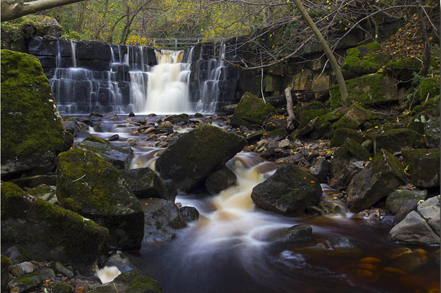
Mill Gill and Whitfield Force Waterfalls
![]()
![]() Just above the little village of Askrigg in Wensleydale there is a lovely walking trail along a river with a series of pretty waterfalls and peaceful woodland. This walk starts in the village and follows the footpath to Mill Gill Force and Whitfield Force falls before returning through some beautiful Yorkshire Dales countryside.
Just above the little village of Askrigg in Wensleydale there is a lovely walking trail along a river with a series of pretty waterfalls and peaceful woodland. This walk starts in the village and follows the footpath to Mill Gill Force and Whitfield Force falls before returning through some beautiful Yorkshire Dales countryside.
It's a really pleasant area with good signed paths, the sound of the running water and nice shady woodland.
The long distance Herriot Way runs through the village. It takes you through areas of the Yorkshire Dales associated with the vet and author James Herriot. You can pick it up to extend your walking in this lovely area.
Mill Gill and Whitfield Force Waterfalls Ordnance Survey Map  - view and print off detailed OS map
Mill Gill and Whitfield Force Waterfalls Open Street Map  - view and print off detailed map
Mill Gill and Whitfield Force Waterfalls OS Map  - Mobile GPS OS Map with Location tracking
Mill Gill and Whitfield Force Waterfalls Open Street Map  - Mobile GPS Map with Location tracking
Pubs/Cafes
Back in the village you could visit The Crown Inn for some post walk refreshment. It's an historic pub of some note dating back to the 18th century. The friendly local inn serves quality bar meals sourced from local suppliers. There's a cosy interior with many original features and a fire. You can find them on the Main Street at postcode DL8 3HQ for your sat navs.
Just up the road is the Grade II listed King's Arms. This fine old pub starred as The Drover's Arms in the original 'All Creatures Great and Small'.
Further Information and Other Local Ideas
Just a few miles to the south there's a lovely circular walk to try around Semer Water. The beautiful lake is notable as the second largest natural lake in North Yorkshire, England after Malham Tarn. Near here there's also the worthy village of Bainbridge. The village includes views of the River Bain and a 15th century hotel which is one of the oldest in Yorkshire.
For more walking ideas in the area see the Yorkshire Dales Walks page.


