Nassington Walks
![]()
![]() Nassington is located just north of Fotheringhay in Northamptonshire.
Nassington is located just north of Fotheringhay in Northamptonshire.
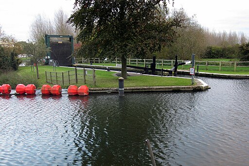
Walkers can enjoy some pleasant trails along the River Nene on the Nene Way near the village. This walk takes you along a section of the waymarked path to neighbouring Yarwell and Wansford. Along the way there are nice views of the river and the surrounding countryside to enjoy.
Please scroll down for the full list of walks near and around Nassington. The detailed maps below also show a range of footpaths, bridleways and cycle paths in the area.
Nassington Ordnance Survey Map  - view and print off detailed OS map
Nassington Open Street Map  - view and print off detailed map
*New* - Walks and Cycle Routes Near Me Map - Waymarked Routes and Mountain Bike Trails>>
Nassington OS Map  - Mobile GPS OS Map with Location tracking
Nassington Open Street Map  - Mobile GPS Map with Location tracking
Walks near Nassington
- Oundle River Nene Walk - A circular riverside walk around the Northamptonshire town of Oundle
- Fotheringhay - This pretty Northamptonshire village has some picturesque thatched cottages, an old castle motte and splendid views of the River Nene.
- Barnwell Country Park - Enjoy lovely waterside walking trails in this country park in Oundle, Northamptonshire
- Nene Way - Follow the River Nene through the beautiful Nene Valley on this fabulous walk through Cambridgeshire, Lincolnshire and Northamptonshire.
The long distance path runs for over 100 miles, passing Northampton, Wellingborough, Oundle, Peterborough and Wisbech.
There's much to enjoy on the way with rushing weirs, a series of historic villages and old mills - Wansford - This picturesque Cambridgeshire village sits in a nice location on the River Nene, near the border with Northamptonshire
- Peterborough - There's lots of fairly easy walks to enjoy around the cathedral city of Peterborough
- Ferry Meadows Country Park - This super country park in Peterborough has several pretty lakes with cycling and walking trails running alongside the water's edge
- Castor Hanglands - Explore the woodland, limestone, wetland grassland and scrub in this large National Nature Reserve near Peterborough
- Crown Lakes Country Park - Enjoy a stroll around the pretty lakes in this country park in Peterborough
- Bedford Purlieus National Nature Reserve - These splendid ancient woods near Peterborough have miles of woodland walking trails to try
- Kings Cliffe Railway Walk - This walk takes you along the old disused railway line in the Northamptonshire village of King's Cliffe.
- Fineshade Woods - Top Lodge in Fineshade Woods has several waymarked cycling and walking trails
- Blatherwycke Lake - This walk visits the little Northamptonshire village of Blatherwycke where you can enjoy a stroll along the pretty lake
- Barnack Hills And Holes - This walk explores the unique landscape of the Barnack Hills and Holes National Nature Reserve in the Cambridgeshire village of Barnack.
- Elton - This Cambridgeshire village is located a few miles west of Peterborough
Pubs/Cafes
Queens Head - The village inn dates back to the 17th century, and is constructed from local limestone. It features a spacious, beamed main bar complete with an open fire and a flagstone serving area that boasts a stone counter. The inn houses two dining areas, divided by a genuine fireplace and chimney breast. The menu is quite diverse, including steaks prepared in a Spanish charcoal oven. There's also a function room located towards the back. The rear of the inn opens up to an appealing garden, and boat moorings are available on the River Nene. Additionally, it offers nine en-suite bedrooms, designed in a courtyard style. You can find them at postcode PE8 6QB for your sat navs.
Further Information and Other Local Ideas
The name of the village translates to 'Promontory place farm/settlement'.
Tracing its origins back to the Anglo-Saxon era, the village once housed an Anglo-Saxon hall that was later acquired by the Viking king, Cnut the Great, and used as one of his royal residences. Post-1017, King Cnut, along with his court including Aethelric, the bishop of Dorchester on Thames, is known to have visited this hall. In 1107, Henry I granted the hall and its lands to Robert Bloet, the Bishop of Lincoln, to establish a prebend.
This village and its manor gained wider recognition through their feature in episode 117, titled "King Cnut's Manor," of the television show "Time Team," which aired on 7 March 2004.
While the manor has since become a private residence, the Prebendal Manor and Tithe Barn Museum, along with its gardens, are accessible to the public for a fee on select days. Notably, the gardens exclusively showcase plants that were introduced before 1485.
Just to the south east is Elton where you can visit another local historic highlight at Elton Hall. The part Gothic house, is surrounded by beautiful parkland and gardens. The hall is open to the public during the summer months and a lovely place for a stroll.


