GPS Cycle and Walking Routescycle iconwalk icon

New Quay To Cwmtydu Walk

3.4 miles (5.4 km)

Ordnance Survey Map Open Streetmap Follow the Ceredigion Coast Path from New Quay To Cwmtydu on this lovely coastal walk along Cardigan Bay.
The route runs for a distance of just over 3 miles, following the waymarked footpath along a splendid cliff top path.
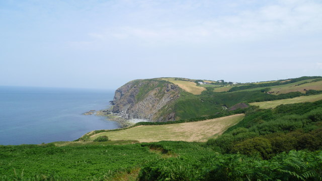
Along the way there's glorious views to the coast and countryside with a number of secluded coves and some splendid rock formations. At the end of the walk you'll come to the delightful hidden gem of Cwmtydu with its attractive little beach and wooded valley.
At the western end you can extend your outing by picking up the Llangrannog to Cwmtydu Walk to visit nearby Llangrannog.
Heading east will take you along the popular New Quay to Aberaeron Coastal Path.

New Quay To Cwmtydu OS Map Ordnance survey map - Mobile GPS OS Map with Location tracking

New Quay To Cwmtydu Open Street Map Open Streetmap - Mobile GPS Map with Location tracking

Cycle Routes and Walking Routes Nearby

Photos

Carreg Walltog, near New Quay, Ceredigion - geograph.org.uk - 2603233

Carreg Walltog, near New Quay, Ceredigion

Part of the Ceredigion Coast Path near New Quay - geograph.org.uk - 2603271

Part of the Ceredigion Coast Path near New Quay

Looking north-northeast along the Wales Coast Path - geograph.org.uk - 4463618

Looking north-northeast along the Wales Coast Path

On the Wales Coast path in July - geograph.org.uk - 4093291

On the Wales Coast path in July

Ceredigion Coast - geograph.org.uk - 3391207

Ceredigion Coast

View above Cwm Soden cove - geograph.org.uk - 4093327

View above Cwm Soden cove

Coast near Castell Bach - geograph.org.uk - 2064362

Coast near Castell Bach

Cwmtydu beach on a hot July afternoon - geograph.org.uk - 4093380

Cwmtydu beach on a hot July afternoon

Video

GPS Files

GPX File

New Quay To Cwmtydu.gpx (On Desktop:Right Click>Save As. On Ipad/Iphone:Click and hold>Download Linked File)