North Cotswold Diamond Way
![]()
![]() This diamond shaped walk was created by the RA's North Cotswold Group to celebrate the 60th Jubilee in 1995. The circular trail takes you through a series of pretty Cotswold villages including Moreton-in-Marsh, Blockley, Icombe, Turkdean, Bourton on the Water, Naunton, Guiting Power and Chipping Campden.
This diamond shaped walk was created by the RA's North Cotswold Group to celebrate the 60th Jubilee in 1995. The circular trail takes you through a series of pretty Cotswold villages including Moreton-in-Marsh, Blockley, Icombe, Turkdean, Bourton on the Water, Naunton, Guiting Power and Chipping Campden.
North Cotswold Diamond Way Ordnance Survey Map  - view and print off detailed OS map
North Cotswold Diamond Way Open Street Map  - view and print off detailed map
North Cotswold Diamond Way OS Map  - Mobile GPS OS Map with Location tracking
North Cotswold Diamond Way Open Street Map  - Mobile GPS Map with Location tracking
Pubs/Cafes
In Daylesford there's the splendid Daylesford Organic Farm. It's a nice place for a stroll with with clover-rich pastures where their organic animals roam freely. There's also refreshments available at the award-winning farmshop & café, kitchens, Bakery and Creamery. You can find them at postcode GL56 0YG for your sat navs.
Further Information and Other Local Ideas
For more walking ideas in the area see the Gloucestershire Walks and the Cotswolds Walks pages.
Cycle Routes and Walking Routes Nearby
Photos
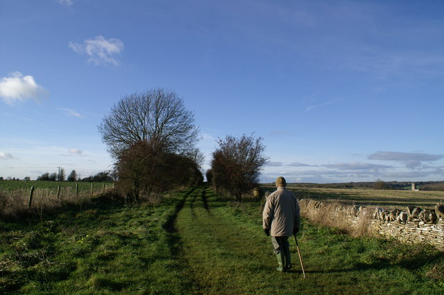
North Cotswold Diamond Way near Northleach. This 60 mile circular route was set up in 1995 and stretches from Northleach to Chipping Campden in the north, Guiting Power in the west and Bourton-on-the-Water in the east. Northleach Church tower is visible on the far right.
The Diamond Way crossing a stream. There is a marker on the post on this side of the bridge showing the symbol of this footpath. The North Cotswold Diamond Way is a scenic route through Gloucestershire created by the Ramblers Association's North Cotswold Group to celebrate their 60th Jubilee in 1995.
Elevation Profile


