Daylesford Walks
![]()
![]() This little village in the Cotswolds has some nice footpaths to follow around its fine old country house. There's also views of the River Evenlode and some pretty neighbouring villages to see in the area as well.
This little village in the Cotswolds has some nice footpaths to follow around its fine old country house. There's also views of the River Evenlode and some pretty neighbouring villages to see in the area as well.
This circular walk from the village visits the Daylesford House Estate and the neighbouring villages of Adlestrop and Oddington. The walk starts in the village next to the old church and follows a section of the North Cotswold Diamond Way east across the Daylesford estate. You'll pass the woodland in the dell, the lake, the quarries and the farm on the public footpaths which run along the southern side of the estate. The lakeside gardens with wooded walks and rare trees and shrubs are occasionally open to the public in the summer months. Here you can get a closer view of the Grade I Listed Georgian House.
After passing the farm the route turns north west to Adlestrop where there's Adlestrop House and a pretty lake to see. You then head south west to Lower Oddington before returning to Daylesford.
Postcode
GL56 0YG - Please note: Postcode may be approximate for some rural locationsDaylesford Ordnance Survey Map  - view and print off detailed OS map
Daylesford Open Street Map  - view and print off detailed map
Daylesford OS Map  - Mobile GPS OS Map with Location tracking
Daylesford Open Street Map  - Mobile GPS Map with Location tracking
Pubs/Cafes
The area includes the splendid Daylesford Organic Farm. It's a nice place for a stroll with with clover-rich pastures where their organic animals roam freely. There's also refreshments available at the award-winning farmshop & café, kitchens, Bakery and Creamery. You can find them near the start of the walk at postcode GL56 0YG for your sat navs.
Further Information and Other Local Ideas
The village is located close to the popular settlement of Stow on the Wold where you can pick up the Stow on the Wold to Bourton on the Water Walk and the Stow on the Wold to the Slaughters Walk.
Just to the south you can pick up the Kingham Walk. The picturesque village was voted 'England's Favourite Village' in 2006. It includes some delightful cottages and a noteworthy church with a 14th century Gothic tower.
Just east of Chipping Norton there's the historic Heythrop Park to explore. The 18th century hotel is surrounded by some beautiful parkland and gardens with miles of walking and cycling trails to try.
For more walking ideas in the area see the Cotswolds Walks page.
Cycle Routes and Walking Routes Nearby
Photos
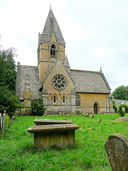
St. Peter's church, Daylesford. Viewed from the north. This gem of a church is hidden from the road by a screen of mature trees.
Daylesford Hill Farm. A view of the farm from the Diamond Way long distance footpath which passes along the driveway. The farm is part of the beautifully maintained estate.
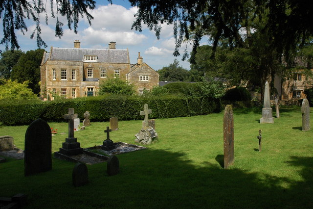
Adlestrop Hous.e Adlestrop House is situated next to the church and is a large impressive Georgian House, it used to be the Rectory. Jane Austin visited on three occasions in 1794,1799 and 1806 and stayed with her uncle who was the Church Rector.


