Oughtibridge and Beeley Wood Walk
![]()
![]() This walk visits Beeley Wood in the village of Oughtibridge in Sheffield.
This walk visits Beeley Wood in the village of Oughtibridge in Sheffield.
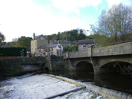
The walk starts in Oughtibridge which is located to the north of the city in the valley of the River Don.
The circular walk starts in the village and heads south to explore the peaceful woods. You can then follow a woodland path along the river to return to the village.
Along the way look out for herons on the river and various woodland birds in Beeley Wood.
To continue your walking in the area head to Grenoside Woods where there's bluebell woods and some fine mountain bike trails. Wharncliffe Woods can also be found in this area.
Oughtibridge and Beeley Wood Ordnance Survey Map  - view and print off detailed OS map
Oughtibridge and Beeley Wood Open Street Map  - view and print off detailed map
Oughtibridge and Beeley Wood OS Map  - Mobile GPS OS Map with Location tracking
Oughtibridge and Beeley Wood Open Street Map  - Mobile GPS Map with Location tracking
Walks near Oughtibridge
- Wharncliffe Woods - Enjoy miles of cycling and walking trails through this large wooded area near Rotherham
- Wentworth Woodhouse - Explore the extensive parkland and gardens surrounding this Grade I listed country house in the village of Wentworth, near Rotherham.
The circular walk starts in Wentworth village and picks up the Rotherham Round long distance trail to take you into Wentworth Park - Westwood Country Park - This pretty country park is located near Wentworth and Rotherham in Yorkshire
- Rotherham Round Walk - This minster town in South Yorkshire is a fine place for walkers with a number of country parks, riverside trails, local reservoirs and some lovely waymarked footpaths to try.
- Barnsley Boundary Walk - A super circular walk around the South Yorkshire town.Walk highlights includes a series of lovely reservoirs, the beautiful Peak District scenery and the splendid Bretton Country Park
- More Hall Reservoir - This reservoir in Stocksbridge has a nice walking trail to try
- Broomhead Reservoir - Enjoy an easy circular walk around this reservoir in South Yorkshire's Ewden Valley near Stocksbridge
- Grenoside Woods - This route visits Grenoside and Greno Woods in Sheffield
Pubs/Cafes
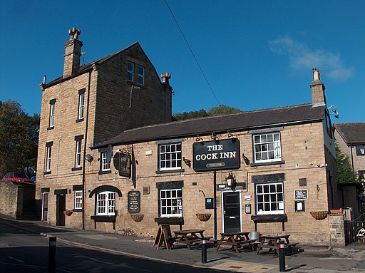
After you exercise you can enjoy some refreshments in the Cock Inn. Located at the heart of the village and situated along the Tour de France route, just where it crosses the River Don before the challenging ascent to Grenoside, this pub has been a local fixture for over two centuries.
The pub offers a variety of food options, yet it maintains ample space to cater to both diners and those who just want to enjoy a drink. It features a single bar that serves a large main area as well as a separate games room. The main room itself is divided into several distinct sections, including a raised area that can be used for meetings or private events. While live sports are broadcasted, the room is spacious enough to provide a comfortable experience for those who might prefer to steer clear of the screens.
The pub enjoys strong support from the village's football teams, both men's and women's, as well as from the cricket teams.
Additionally, patrons can explore a diverse Craft Beer Menu, adding to the pub's appeal as a vibrant community hub. You can find them at 5 Bridge Hill with a postcode of S35 0FL.


