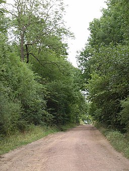
Parlington Woods
![]()
![]() This walk takes you through Parlington Woods near Aberford and Garforth in Yorkshire.
This walk takes you through Parlington Woods near Aberford and Garforth in Yorkshire.
The historic woods are part of the old Parlington Estate, seat of the Gascoigne family. There's an interesting grade II* listed Triumphal Arch and some picturesque old cottages here.
You can pick up a tarmac path just south of Aberford. Follow the lane west and it will take you through Parlington Park and woods.
Postcode
LS25 3EH - Please note: Postcode may be approximate for some rural locationsPlease click here for more information
Parlington Woods Ordnance Survey Map  - view and print off detailed OS map
Parlington Woods Open Street Map  - view and print off detailed map
Parlington Woods OS Map  - Mobile GPS OS Map with Location tracking
Parlington Woods Open Street Map  - Mobile GPS Map with Location tracking
Further Information and Other Local Ideas
Near Aberford you can pick up the Hazlewood Castle Walk where you can visit the nearby country estate. Here you'll find expansive bluebell woods and a mountain bike trail located to the west of the 18th century mansion which is now run as a hotel.
Just to the north you can explore the villages of Barwick-in-Elmet and Thorner. Here you could visit Bramham Park where there are hundreds of acres of parkland, gardens, woodland and countryside to explore. The landscaped park surrounds the historic 18th century Bramham House which is a Grade I listed building.
Cycle Routes and Walking Routes Nearby
Photos
Woodland Cottages. Parlington Lane runs West to East and bisects the Parlington Hall woodlands, North of the M1, which itself passes North of Garforth. The Estate was originally owned by the Gascoigne family and built from the profits of coal mining.


