Peaslake Circular Walk
![]()
![]() This village in Surrey is in a nice location for exploring the Surrey Hills and Greensand Ridge. This circular walk takes you to some of the highlights of the area including the expansive woodland of Hurt Wood, the iconic Leith Hill and the pretty Abinger Common. The route runs for a distance of just over 10 miles with some moderate climbs on the way.
This village in Surrey is in a nice location for exploring the Surrey Hills and Greensand Ridge. This circular walk takes you to some of the highlights of the area including the expansive woodland of Hurt Wood, the iconic Leith Hill and the pretty Abinger Common. The route runs for a distance of just over 10 miles with some moderate climbs on the way.
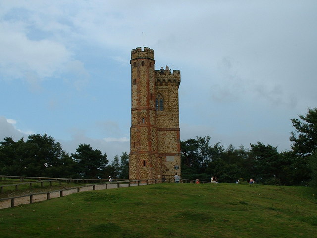
The walk starts in the village and heads south through Hurt Wood where you can see lots flowering Rhodedendron in the spring months. At the Duke of Kent School you can pick up the Greensand Way. The long distance, waymarked trail will guide you east through Pasture Wood and then up on to the summit of Leith Hill. The hill is the highest point in the South East and the highest hill on the Greensand Ridge. On the summit of Leith Hill is an 18th century Gothic tower, with panoramic views northwards to London and south to the English Channel.
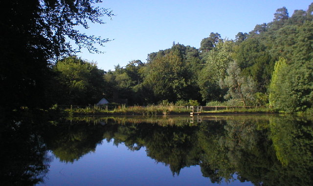
After taking in the views the route turns north towards Broadmoor before heading west to Abinger Common. Here you'll find miles of nice woodland trails, ponds, streams and great views from the many viewpoints on the expansive common.
The route continues west, passsing the village of Holmbury St Mary, before a final woodland section takes you back into Peaslake.
Peaslake Ordnance Survey Map  - view and print off detailed OS map
Peaslake Open Street Map  - view and print off detailed map
*New* - Walks and Cycle Routes Near Me Map - Waymarked Routes and Mountain Bike Trails>>
Peaslake OS Map  - Mobile GPS OS Map with Location tracking
Peaslake Open Street Map  - Mobile GPS Map with Location tracking
Walks near Peaslake
- Leith Hill - Climb to the highest point in the South East on this challenging circular walk in the Surrey Hills AONB.
- Abinger Common - Enjoy a walk across Abinger and Wotton Commons before a climb to Leith Hill on this circular walk in the Mole Valley
- Abinger Roughs - This circular walk in Abinger Hammer takes you around an attractive, elevated woodland area.
Start your walk from the car park at the eastern end of the site - Shere - The attractive Surrey village of Shere is in a great location for exploring the Surrey Hills and the North Downs
- Winterfold Forest - This lovely area of the Surrey Hills is a popular place for walkers and cyclists
- Greensand Way - The Greensand Way runs from Haslemere in Surrey to Hamstreet in Kent following the ridge of greensand rock that crosses the two counties
- Holmbury Hill - Climb to the 856 feet (261 m) summit of Holmbury Hill on this circular walk in the Surrey Hills
- Holmwood Common - This National Trust managed common has miles of walking trails to try
- Friday Street - This pretty little hamlet sits in a pleasant location on the slopes of Leith Hill in Surrey.
- Friday Street - This pretty little hamlet sits in a pleasant location on the slopes of Leith Hill in Surrey.
- Gomshall - This pretty Surrey based village is a great place to start a walk
Further Information and Other Local Ideas
The circular Friday Street Walk can be picked up on nearby Abinger Common. It explores the pretty Friday Street Mill Pond and the 17th century Wotton House Estate before heading to the Tillingbourne Waterfall on the River Tillingbourne.


