Place Fell
![]()
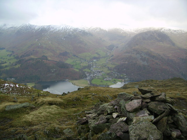
![]() This walk climbs to Place Fell from the village of Patterdale for fine views over Ullswater. The fell is located just to the north east of the village, and just to the east of the southern end of the lake. It's a popular one to do in the Ullswater area because of a fairly decent path and a gradual ascent.
This walk climbs to Place Fell from the village of Patterdale for fine views over Ullswater. The fell is located just to the north east of the village, and just to the east of the southern end of the lake. It's a popular one to do in the Ullswater area because of a fairly decent path and a gradual ascent.
Start the walk from the public car park in the small village of Patterdale, located at the southern end of Ullswater. From the village you head east to cross the pretty Goldrill Beck. Paths then take you north east past Rooking to Boredale Hause. You turn north here, passing Steel Edge, Redgate Head, Round How and Capel Crags before coming to Place Fell. The summit stands at a height of 657 m (2,156 ft) and includes an OS triangulation column and cairn placed about ten yards apart on two competing high-points. There's excellent views across the lake to the surrounding fells, including the Helvellyn range. This route returns to the village on the same paths, though you can turn it into a longer circular walk by continuing north to Hart Crag and High Knott. You can then descend to the lakeside and follow a path south back to the village.
Place Fell Ordnance Survey Map  - view and print off detailed OS map
Place Fell Open Street Map  - view and print off detailed map
Place Fell OS Map  - Mobile GPS OS Map with Location tracking
Place Fell Open Street Map  - Mobile GPS Map with Location tracking
Pubs/Cafes
Back in Patterdale, pay a visit to the noteworthy White Lion Inn for some refreshments. The pub has an interesting history having existed since the early 1800s. It's said that Wordsworth was in the bar as news arrived that Nelson had died at Trafalgar in 1805. The interior is full of old world charm while outside there's a nice beer garden just across the road. It's a lovely place to relax and soak in the fine views if the weather is good. You can find the pub in the village at postcode CA11 0NW for your sat navs.
Dog Walking
It's a great walk for fit dogs and the White Lion Inn mentioned above is also dog friendly.
Further Information and Other Local Ideas
The circular climb to St Sunday Crag Walk is another worthy climb which starts from Patterdale. It's located to the south west and will take you up to the crag and to the pretty Grisdale Tarn and Grisedale Beck.
The walk up to Angle Tarn and the Angletarn Pikes is another favourite from the village.
For more walking ideas in the area see the Lake District Walks page.


