Pontefract Racecourse Walk
![]()
![]() This circular walk visits Pontefract Park Racecourse in this pleasant West Yorkshire market town.
This circular walk visits Pontefract Park Racecourse in this pleasant West Yorkshire market town.
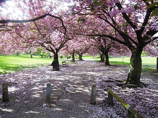
The walk starts just to the north of the town near to Tanshelf Station. From her you can pick up footpaths heading north around the park. The north section of the park is also classified as a Local Nature Reserve, with habitats including grassland, a lake, woodland, wetland and small areas of open water. It's a pleasant place for a stroll and you should also see some wildlife around the lake.
Other public footpaths branch out to the east towards Featherstone if you'd like to extend the walk.
Postcode
WF8 4RD - Please note: Postcode may be approximate for some rural locationsPontefract Racecourse Walk Ordnance Survey Map  - view and print off detailed OS map
Pontefract Racecourse Walk Open Street Map  - view and print off detailed map
*New* - Walks and Cycle Routes Near Me Map - Waymarked Routes and Mountain Bike Trails>>
Pontefract Racecourse Walk OS Map  - Mobile GPS OS Map with Location tracking
Pontefract Racecourse Walk Open Street Map  - Mobile GPS Map with Location tracking
Walks near Pontefract Racecourse Walk
- Fairburn Ings - This lovely nature reserve in the Aire Valley has some nice footpaths to follow around the substantial site
- Wakefield Canal - Follow the Wakefield Branch of the Aire and Calder Navigation Canal from Wakefield to Castleford on this waterside walk in West Yorkshire
- Trans Pennine Trail - This terrific walking and cycling trail runs from coast to coast across northern England entirely on surfaced paths
- Pugneys Country Park - This 250 acre park contains two lakes with pleasant waterside footpaths
- Barnsley Canal - Enjoy a waterside walk or cycle along the Barnsley Canal on this easy route near Royston
- Castleford - Castleford is a town in West Yorkshire, located a few miles south east of the city of Leeds
- Brockadale Nature Reserve - This lovely nature reserve near Pontefract has miles of woodland walking trails and a riverside path along the River Went
- Allerton Bywater - This village near Leeds has a series of pleasant waterside footpaths to try
Pubs/Cafes
- Olde Tavern - this fine pub includes an extended conservatory leading out to a pleasant covered decking and a spacious garden. It's a fine place to relax on a summer day. They serve good food and can be found at 34 South Baileygate with a postcode of WF8 2JL for your sat navs.
- Robin Hood - a friendly local's bar and a winner of several local CAMRA awards. It's a historic place and one of the oldest pubs in the town. You can find them on Wakefield Road at postcode WF8 4HN.
Dog Walking
The park is a popular place for dog walkers so you'll probably bump into a few other owners with their pets. There's also a racecourse where you'll often see people running their pets round the park.
The Robin Hood mentioned above is also dog friendly.
Further Information and Other Local Ideas
A couple of miles north of the park you'll find the Fairburn Ings Nature Reserve near Allerton Bywater and Castleford. It's a nice place to extend your walking with a number of pretty lakes and nice riverside paths along the River Aire. You could also pick up the Wakefield Canal in Castleford and enjoy a waterside walk along the towpath.
Brockadale Nature Reserve is a lovely peaceful place where you can go for an easy walk near the town. Here you'll find woodland, wildflower meadows, views of the River Went and lots of wildlife.


