Portreath Walks - Portreath to Hayle Walk
![]()
![]() This north Cornish fishing village has a pretty harbour and two popular sandy beaches. As such it's a nice place to start a walk with coastal paths in both directions and a local country park to visit as well.
This north Cornish fishing village has a pretty harbour and two popular sandy beaches. As such it's a nice place to start a walk with coastal paths in both directions and a local country park to visit as well.
This walk takes you from Portreath to Hayle along the coastal path.
The walk starts in the village and heads south along the South West Coast Path, passing Carvannel Downs and Tehidy Country Park on the way. You continue along Reskajeage Downs to Hudder Down and Godrevy Head, where you will pass the lighthouse.
After rounding the headland you continue south past ,Gwithian and Towans before arriving in Hayle where you can enjoy a stroll along the beautiful Hayle Estuary.
Postcode
TR16 4LA - Please note: Postcode may be approximate for some rural locationsPortreath Ordnance Survey Map  - view and print off detailed OS map
Portreath Open Street Map  - view and print off detailed map
Portreath OS Map  - Mobile GPS OS Map with Location tracking
Portreath Open Street Map  - Mobile GPS Map with Location tracking
Walks near Portreath
- South West Coast Path - This incredible 600 mile walk follows the coast from Minehead in Somerset, through Devon and Cornwall and onto the finish point at Poole in Dorset
- Tehidy Country Park - Explore 250 acres of peaceful woods and lakes at Tehidy, near Portreath, in Cornwall
- Godrevy Head - Explore Godrevy Head and enjoy wonderful views of St Ives Bay and the Cornish coast on this splendid coastal walk
- Hayle Estuary - Enjoy a walk or cycle around the beautiful Hayle Estuary RSPB reserve in Cornwall
- Mineral Tramways Trail - Also known as the Bissoe Trail, this is a fabulous, largely traffic free ride or walk, from Portreath to Devoran
- Redruth - This Cornish town has some nice walking trails exploring the settlement's rich mining history
- Great Flat Lode Trail - This is a short, circular off road walk or cycle that circles the historic hilltop site of Carn Brea
- Truro - Truro is notable as Cornwall's only city and mainland Britain's southernmost city
- Carn Brea - This walk explores the ancient Carn Brea hill fort and the Bassett Monument above Redruth in Cornwall.
- Gwithian - This walk explores the area around the village of Gwithian on the West Cornwall coast.
Pubs/Cafes
The Portreath Arms is a good choice for refreshment in the village. The pub has an interesting history having been originally built to accommodate the crews of ships trading at the harbour over 100 years ago. There are lovely views across the harbour with outdoor seating available if the sun is shining. You can find them in the village on The Square at postcode TR16 4LA for your sat navs.
Dog Walking
The coastal paths make for a fine bracing walk for you and your dog. Please note that the Portreath beach has a dog ban in July and August during the day. The Portreath Arms mentioned above is also very dog friendly with treats available at the bar.
Further Information and Other Local Ideas
The Mineral Tramways Trail starts in Portreath. It will take you to Devoran along a shared cycling and walking trail, passing some of Cornwall's historic mine buildings on the way.
For more walking ideas in the area see the Cornwall Walks page.
Photos
Tregea Hill. This picture shows how the terraces of the older settlement were set back at the hillfoot away from the industrialised area of the village.
Outer Harbour, Portreath. The outer harbour was built in 1801 to export copper ore to Wales and import Welsh coal in return to power the steam engines that pumped the Cornish mines. The white house with the bay windows is the former Harbour Office which was still in use up to the 1930s. The small stone building on the skyline by the blue forestay of the yacht is the 'Pepperpot'. This was built around 1800 to serve as a Pilot's lookout.
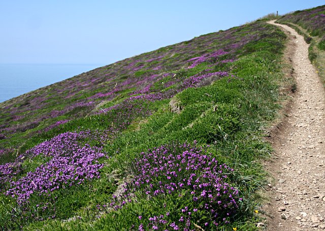
Vegetation on Carvannel Downs. The most prominent feature is the Bell Heather which has just started to flower in mid June. The worn path is the Southwest Coast Path.
Porth-cadjack Cove at Low Tide. The rocky Porth-cadjack Cove at low tide with Samphire Island in the background. The secluded cove is located just south of the village.
Hayle viaduct, near to Hayle, Cornwall, Great Britain. On the Penzance to Paddington main line Hayle viaduct is seen with the late evening light on the sides. For most of the day the sun is on the other side of the viaduct.


