Carn Brea Walk
![]()
![]() This walk explores the ancient Carn Brea hill fort and the Bassett Monument above Redruth in Cornwall.
This walk explores the ancient Carn Brea hill fort and the Bassett Monument above Redruth in Cornwall.
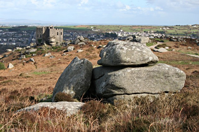
You can start the walk from the small parking area next to the hill. It's a small car park so you could try the South Wheal Frances car park just to the south at a postcode of TR16 6JX. From the hill top car park you can pick up a circular footpath taking you around the site. This includes the folly of Carn Brea Castle which was built in the 18th century by the Basset family as a hunting lodge. At the high point on the hill there's also the Basset Monument, a Celtic cross erected as a monument to Francis Basset, 1st Baron de Dunstanville and Basset. On the hill you'll also find attractive gorse heathland, interesting granite rock formations and wonderful views over the surrounding area.
Postcode
TR16 6SL - Please note: Postcode may be approximate for some rural locationsCarn Brea Ordnance Survey Map  - view and print off detailed OS map
Carn Brea Open Street Map  - view and print off detailed map
Carn Brea OS Map  - Mobile GPS OS Map with Location tracking
Carn Brea Open Street Map  - Mobile GPS Map with Location tracking
Pubs/Cafes
On the hill there's the Carn Brea Castle Restaurant to visit. Set in the 18th century castle the restaurant serves high quality food. You can also explore the historic building where you can gain access to the roof for excellent views over the area.
Just to the south of the hill there's also The Countryman Inn to consider. They have a good menu and a nice outdoor seating area with views of the little village. You can find them in Piece, Carnkie with a postcode of TR16 6SG for your sat navs.
Dog Walking
The hill top and heathland paths make for a bracing dog walk. The Countryman Inn mentioned above is also dog friendly.
Further Information and Other Local Ideas
Just to the north you can pick up the Great Flat Lode Trail. This circular cycling and walking route explores Cornwall's heritage mines.
For a quieter climb in the town head east and you could visit Carn Marth. The hill is a fine place to explore with another excellent viewpoint, a pretty quarry lake and an outdoor ampitheatre which runs performances during summer.
Near here there's another amphitheatre to explore at Gwennap Pit. The site has some historical significance having been used by Methodist preacher John Wesley preached several times between 1762 and 1789.
Just a few miles to the east there's some great walking and mountain bike trails to be found at the Poldice Valley. The area has a wonderful moon like appearance with the historic Poldice Mine buildings adding to the atmospheric landscape.
For more walking ideas in the area see the Cornwall Walks page.
Cycle Routes and Walking Routes Nearby
Photos
Basset De Dunstanville monument over Carn Brea. View taking in the monument and castle as well as the general granite landscape of the hilltop.
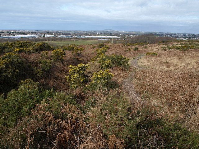
On Carn Brea. Looking across grass and gorse beside a granite rock, down towards the western outskirts of Redruth. Behind the pale business unit in the centre is Camborne Redruth Community Hospital. The A3047 dual carriageway curves away beyond it; the viaduct above the hospital is on the A30.


