Saltaire Canal Walk with OS Map
![]()
![]() This Victorian model village and UNESCO World Heritage Site is one of the highlights of the Bradford area. The wonderfully preserved village includes the grade II listed Victoria Hall and Salt's Mill with its shops, cafes and galleries. You can explore the village with its wonderful buildings and history before picking up the Leeds and Liverpool Canal towpath to take you to the splendid Bingley 5 Rise Locks. This route also takes you into the lovely Roberts Park just over the water. The park is grade II listed in English Heritage's Register of Parks and Gardens. It links to Shipley Glen where there are nice woodland trails along a pretty beck and the super Shipley Glen Tramway. It is the oldest funicular tramway in the UK. You can ride the railway for a small fee.
This Victorian model village and UNESCO World Heritage Site is one of the highlights of the Bradford area. The wonderfully preserved village includes the grade II listed Victoria Hall and Salt's Mill with its shops, cafes and galleries. You can explore the village with its wonderful buildings and history before picking up the Leeds and Liverpool Canal towpath to take you to the splendid Bingley 5 Rise Locks. This route also takes you into the lovely Roberts Park just over the water. The park is grade II listed in English Heritage's Register of Parks and Gardens. It links to Shipley Glen where there are nice woodland trails along a pretty beck and the super Shipley Glen Tramway. It is the oldest funicular tramway in the UK. You can ride the railway for a small fee.
The River Aire also runs through the village so you can also pick up the riverside footpath to further explore the area. Head west and and you can visit the country park at Bingley St Ives. Here you'll find woodland, gardens, ponds and parkland set in a wonderful 500 acre estate.
A few miles to the south you will find the delightful Chellow Dene Reservoir.
You can virtually explore the Saltaire village using the google street view link below!
Please click here for more information
Saltaire Ordnance Survey Map  - view and print off detailed OS map
Saltaire Open Street Map  - view and print off detailed map
*New* - Walks and Cycle Routes Near Me Map - Waymarked Routes and Mountain Bike Trails>>
Saltaire OS Map  - Mobile GPS OS Map with Location tracking
Saltaire Open Street Map  - Mobile GPS Map with Location tracking
Explore the Area with Google Street View 
Cycle Routes and Walking Routes Nearby
Photos
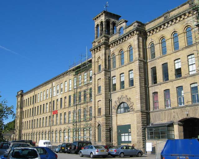
Salts Mill. When this was built it was at the cutting edge of the technology of its period, now it has been redeveloped and houses a gallery of David Hockney's work, restaurant and shops including Kath Libbert Jewellery - she has recently staged an exhibition of contemporary jewellery celebrating the history of the building.
Five Rise Locks, Bingley. The well known local landmark between Bingley and Crossflats on the Leeds & Liverpool Canal.
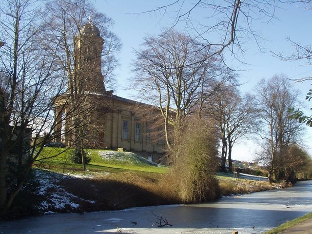
Saltaire United Reformed Church. This church was a Congregational Church, until the Congregationalists and Presbyterians united. It is a Grade 1 listed building which was built in 1859 by Sir Titus Salt, who is interred in the Mausoleum on the far side.
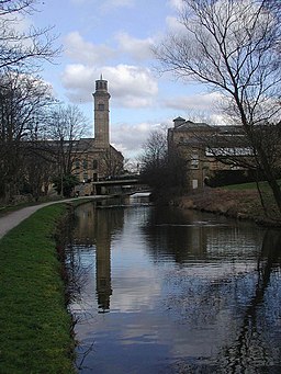
Salt's Mill from the canal. Salt's Mill is mainly on the south bank of the Leeds and Liverpool canal. But there is also a building on the north bank, connected by an enclosed bridge. On a Monday morning in early March, it was really quiet between the buildings, the loudest sound was the ducks quacking. Think of it 150 years ago when barges would have been loading and unloading at the large doors on the ground floor in the foreground.


